Coastal erosion and coastal floods
Sea levels and future flood risk are higher than previously assumed
March 5, 2026
Sea-level rise is one of the most dramatic consequences of climate change and a huge threat to coastal populations. Societies in low-lying coastal zones and deltas are generally aware that they need to act in response to sea-level rise and are often taking the first steps to adapt. They rely on vulnerability assessments and future projections of the scientific community. In a recent study in Nature, scientists ring the alarm bell concluding that sea-level data used in these assessments and future projections are generally incorrect. As a result, sea level is generally much higher than assumed so far. The scientists evaluated 385 peer-reviewed, scientific publications, published between 2009 and 2025. This study was conducted on a global scale.
More than 99% inadequate
It is relative sea-level rise – the rise of the level of the sea relative to the level of the land – that determines coastal flood risk. In most densely populated coastal zones, sea level is rising and land is subsiding. The latter results mostly from the abstraction of groundwater and fossil fuels. For reliable sea-level rise and coastal hazard impact assessments, it is essential to properly combine sea-level and land elevation to correctly judge sea level relative to the land. The Nature study shows that ‘more than 99% of the evaluated impact assessments handled sea-level and land elevation data inadequately, thereby misjudging sea level relative to coastal elevation’.
Discrepancy with actual sea level data
The mistake that most scientists make in their studies so far is that they fully rely on the sea-level data based on geoid models, rather than using actual sea-level measurements. A geoid model approximates mean sea level based on gravity and the rotation of the Earth. In parts of the Earth with few gravity observations, the uncertainties in sea level according to geoid models can be large.
Moreover, the actual level of the sea surface is not just determined by the gravity and rotation of Earth, but also by ocean currents and large-scale circulation, winds, tides, seawater temperature and salinity. These additional effects can only be captured by including, for instance, local tide gauge measurements and satellite altimetry. Of all 385 scientific publications, the authors of the Nature study encountered only two papers that reflected on the potential discrepancy between geoid and actual sea level data.
Sea level 0.24-0.27 m higher
On a global scale, measured coastal sea level appears to be 0.24-0.27 m higher than assumed in most hazard assessments based on these geoids, the Nature study shows. Regionally, deviations can be much larger, up to more than 1 m in the Indo-Pacific.
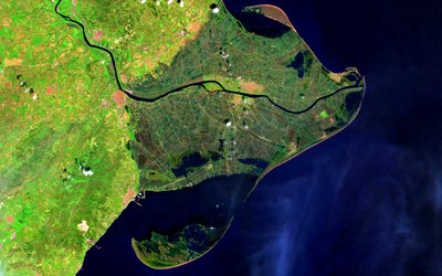
The underestimation of sea level is largest in Southeast Asia – hosting large, populous and low-lying river deltas – and the Pacific Region – with often lowly-elevated atolls. Here, the underestimation is more than 1 m. On average, relying on the geoid models leads to an underestimation of sea level. At some locations, however, an overestimation is observed, for instance for the northern Mediterranean coast. Discrepancies between actual mean sea level and the geoid approximation are lowest in Eastern North America, as well as Northern and Western Europe.
Studies underestimate exposure
As a result of the incorrect handling of sea level and land elevation data in most scientific studies, coastal flood risk is generally underestimated. A hypothetical 1 m of relative sea-level rise would lead to 31–37% more land and 48–68% more people falling below sea level when data are used that are correctly referenced to actual measurements, the Nature study shows.
In Southeast Asia, the estimated land area and population below mean sea level following 1 m relative sea level rise increases up to 94% and 96%, respectively.
A blind spot
This study has revealed ‘a community-wide blind spot’, as the authors call it, ‘which calls for a systemic change in how we deal with sea-level and (coastal) land elevation data in the global scientific community and beyond’. Their results have far-reaching implications for existing coastal adaptation, protection and mitigation strategies. Many of the 385 scientific publications in their evaluation are used to inform global disaster risk reduction and underpin projections of coastal vulnerability, adaptation needs and timelines. Exposure thresholds may be reached much sooner than previously projected.
Source: Seeger and Minderhoud, 2026. Nature.