Italy
Coastal flood risk Italy
Sea level rise in Italy in the past
Only a few long sea level records spanning to the beginning of the 1900s exist in the Mediterranean Sea and these are located at the northern coasts of the western Mediterranean (Marseille and Genoa) and at the northern coasts of the Adriatic Sea (Trieste and Venice) (1). Venice has particularities due to variations in local subsidence and therefore it is not usable in the context of long term sea level trends (2). Nevertheless it is worth noting that sea level proxy data indicate that the trend has remained unaltered in Venice since the early 18th century (3).
The sea level trends for the three longer stations are presently in the range 1.1 - 1.3 mm/yr, thus lower than the estimated global value for sea level rise. New data for Trieste extending the record for this tide gauge fifteen years back to 1875 leave the above estimate unaffected (4).
Two periods of sea level variability must be discussed further. Between 1960 and the beginning of the 1990s sea level in the Mediterranean Sea was either not changing or decreasing (5) due to atmospheric pressure changes during the winter period (6) as well as temperature reduction and salinity changes linked to the North Atlantic Oscillation (NAO) (7) or to the thermohaline Mediterranean circulation (8).
Nevertheless, it appears that the temperature and salinity changes are constrained in the northern part of the basin while east-west gradients on atmospheric pressure as well as evaporation minus precipitation also exist. The second period concerns the era of satellite altimetry and in particular Topex/Poseidon during which fast sea level rise was observed at the Eastern Mediterranean Sea and was linked with changes in observed sea surface temperature (9) The observed sea level values and their temperature forcing has been confirmed by the use of climatological data of oceanic temperatures (7).
Sea level rise since 1350 reconstructed for Venice
A rising sea and a sinking city
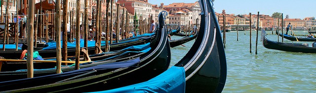
The city of Venice in Italy, one of UNESCO’s most famous World Heritage Sites, is subsiding and absolute sea level is rising. The combination of these two processes is relative sea level rise, the rise of sea level with respect to the subsiding land. Knowledge of relative sea level rise is crucial for the safeguarding of the city. Today, the sea has reached the level of ground floors and is causing dramatic damage to buildings and monuments (52). Some people have raised the floors and bricked up the lower parts of doors to avoid the penetration of seawater; others have built a wooden dock walkway or a floating platform in front of the door (51).
Preferably data on sea level rise cover several centuries since short time series of water level may suffer too much from uncertainties and short-term fluctuations caused by several (natural and man-made) factors. The longer a time series of sea level, the more the trend of sea level rise stands out with respect to this short term variability.
Three clues to reconstruct sea level rise
The existing tide gauge record of sea level for Venice goes back to 1871. Scientists succeeded in extending this time series back to 1571 by studying the green algae belt on paintings. In a recent novel approach, scientist went even further back in time, to 1350, by studying the submergence level of the steps of water stairs of palaces on the Grand Canal (51).
Clue 1: Tide gauge registrations since 1871. From the tide gauge record it was concluded that the observed average relative sea level rise in Venice was 2.5 ± 0.2 mm per year over the period 1871-2014. The average subsidence of Venice and its surrounding land in this period was 1.5 ± 0.3 mm per year. Thus the sea level near Venice has risen by 1.0 ± 0.3 mm per year since 1871, quite comparable to the value of 1.1-1.5 mm per year that was found for the Mediterranean over the past century (53).
Clue 2: Algae belts on paintings show sea level in the past since 1571. Green algae on paintings were first studied for paintings covering the period 1727-1758. The algae belt is the biological tracer of sea water level. By comparing the algae level in the paintings with the current one, average relative sea level rise was estimated to be 2.3 ± 0.4 mm per year (54). Second, a comparison was made between algae belts on these paintings of 1727-1758 and a painting made in 1571. This comparison revealed a relative sea level rise of 1.2 ± 0.4 mm per year (55). This figure is close to the estimated land subsidence for this period and suggests that the absolute sea level rise over the seventeenth century may have been very small (51).
Clue 3: Submergence level steps of water stairs palaces show sea level rise since 1350. The submergence level of the steps of water stairs of palaces on the Grand Canal provides an exceptionally long series (i.e. 664 years) of data on sea level rise. In Venice, canals are more important than streets, and the Grand Canal is the main canal with the most magnificent palaces on both sides. The main entrances of the palaces are on the Grand Canal with water stairs, i.e. stairways, leading down to welcome guests and unload supplies arriving by boat. Nowadays, water stairs are fully or almost fully submerged and disappear underwater. The bottom step, in association with the building date, provides a useful proxy to reconstruct the change of relative sea level over the centuries. The advantage is that there are numerous water stairs and they may provide a very long, high-resolution series. Originally, the bottom step of the water stairs of the historic palaces was built in relation to the sea level and the slippery algae belt, while today, the water stairs are mostly submerged. An underwater survey of 78 water stairs has provided new data about relative sea level rise since 1350. The results show that relative sea level in Venice was always rising at an increasingly fast rate (51).
Steps reveal turning point sea level change
In fact, the results suggest a turning point in the change of absolute sea level for the mid fifteenth century, quite consistent with the literature: sea level must have dropped from a maximum elevation during the Mediaeval Warm Period, when absolute sea level was 12 to 21 cm higher than today, to a minimum around 1730, as a result of the Little Ice Age (51). Since the Little Ice Age global warming has led to an accelerated sea level rise (56), which is illustrated by the long-term data set for Venice.
Global sea level rise
Observations
For the latest results: see Europe Coastal floods
Projections
For the latest results: see Europe Coastal floods
Extreme water levels - Global trends
More recent studies provide additional evidence that trends in extreme coastal high water across the globe reflect the increases in mean sea level (33), suggesting that mean sea level rise rather than changes in storminess are largely contributing to this increase (although data are sparse in many regions and this lowers the confidence in this assessment). It is therefore considered likely that sea level rise has led to a change in extreme coastal high water levels. It is likely that there has been an anthropogenic influence on increasing extreme coastal high water levels via mean sea level contributions. While changes in storminess may contribute to changes in sea level extremes, the limited geographical coverage of studies to date and the uncertainties associated with storminess changes overall mean that a general assessment of the effects of storminess changes on storm surge is not possible at this time.
On the basis of studies of observed trends in extreme coastal high water levels it is very likely that mean sea level rise will contribute to upward trends in the future.
Relative sea level rise - Future trends along the Mediterranean coast
Locally, projected relative sea level rise at the northern Mediterranean coasts deviates substantially from the IPCC projections because of high rates of land subsidence or uplift. This is especially the case in Italy where projected relative sea level rise is much higher near Venice and the Po Delta because of high rates of land subsidence. High land uplift in the volcanic area near Naples of about 9.5 mm per year, on the higher hand, leads to very low values of projected relative sea level rise. Compared to the IPCC projections, projected relative sea level rise in 2100 is almost 1.1 m higher in the Po Delta and 0,8 m lower at the coast of Naples. Land uplift is an exception in the Mediterranean. Subsidence, on the other hand, occurs at several locations, and is also very high in the Thessaloniki plain in Greece and the Rhone delta in France (61).
Extreme waves - Future trends along the Mediterranean coast
Recent regional studies provide evidence for projected future declines in extreme wave height in the Mediterranean Sea (34). However, considerable variation in projections can arise from the different climate models and scenarios used to force wave models, which lowers the confidence in the projections (35).
Vulnerabilities - Coastal flood risk
For the Italian coasts sea level rise will imply high risks. About 4500 km2 of coastal areas and plains would be at risk of coastal flooding in 2080 (according to a study carried out by NASA-GISS); floods might occur in northern Italy (Upper Adriatic Sea), central Italy (the coastline between Ancona and Pescara, the coasts near Rome and Naples) and in southern Italy (Gulf of Manfredonia, coasts between Taranto and Brindisi, eastern- southern Sicily) (4,10).
A sea level rise of 0.20-0.70 metres has been projected for 2100. The major coastal areas at risk of sea flooding are the Padano-Venetian, Versilia, Fondi and Pontina plains with negative effects on the tourism industry (as for the Padano-Venetian and Versilia plains) and on the production activities (as for the Pontina and Fondi plains), due to the loss of seashore and damages to infrastructures and services. Other concerns for Italy in relation to projected climate changes have been identified as follows: loss of humid zones nearby rivers estuaries; salt water intrusion into coastal fresh-water beds, with adverse impacts on agriculture and freshwater supply; coastal erosion (4).
Subsidence in Italy is increased in the last years as a consequence of human activities, especially excessive groundwater withdrawal. In the eastern Po plain in north Italy, the recent effects of human activities on subsidence has been evaluated to be at least an order of magnitude higher than that due only to long-term natural processes. A clear-cut correlation between flood frequency and rapid subsidence can be also demonstrated (11).
A technical report of the Ministry for the Environment, Land and Sea (12) quantifies the areas with high risk of flooding: they cover an area of 7.774 km2, corresponding to 2,6% of the national territory. Floods can cause several consequences to human health, infrastructures and the environment. The most dramatic floods in Italy occurred in the Po (1951, 1994, and 2000) and Arno river basin (1966).
Vulnerabilities - Venice
Venice in numbers
The population of Venice decreased from 184,000 inhabitants in 1950 to less than 90,000 at the beginning of the 1990s; at present the resident population is reduced to 70,000 inhabitants, with an increasing percentage of old people. This demographic decline is due to various causes; one of the most important is the progressive reduction of industry with an attendant increase in unemployment. In addition, because of the state of decay of the houses, the increasing frequency of floods, the relatively high cost of living and the peculiar Venetian way of life, which is not always appreciated by the younger generation, increasing numbers of inhabitants are moving from the city to the urban centers of the terra firma, such as Mestre and Marghera (15).
Tourism is Venice’s most important economic resource, but also a major source of pollution, and negatively influences the quality of life of the inhabitants. At present the mean ratio between the number of tourist presences and that of the inhabitants is about 160 (15).
The lagoon of Venice is the largest Mediterranean lagoon. It is one of only two tidal coastal wetlands in the Mediterranean region (16).
The lagoon of Venice - Permanently unstable
The Lagoon of Venice, like most lagoons, is liable to major and sudden variations and, consequently, its equilibrium is permanently unstable. This is the cause of its great changes, evolving either into a marine bay or, by a natural succession, through a salt-marsh environment, to dry land. As a consequence, on the geological scale, the life of a lagoon is always rather short.
Indeed, the load of solid material discharged into the lagoon from its tributaries would bury it or, if the violence of the sea exceeded the solid load from the watershed, the sandbars protecting the lagoon would be demolished and the lagoon transformed into a marine bay. This would be the fate of the Lagoon of Venice without the uninterrupted work undertaken by the Serenissima Republic of Venice to arrest the processes of the natural succession. Thanks to this work, the lagoon has maintained its identity through the centuries. The Lagoon of Venice is protected from the Adriatic Sea by sandbars (Cavallino, Lido and Pellestrina) which are interrupted by three inlets-opening (bocche di porto): Lido, Malamocco and Chioggia (15).
About a quarter (140 km2) of the total lagoon surface is occupied by mud flats which form marshy areas (barene), emerging from the water only during low tide. Another characteristic of the Lagoon of Venice consists in its numerous islands, many of them located in the central basin of the lagoon. The total area occupied by the islands amounts to 40 km2 (15).
At present, the most crucial problems of Venice and its lagoon are: the lowering of the level of the city in relation to that of the sea, the continuous decline in the number of inhabitants, the increasing frequency of the “high water” phenomenon, air and water pollution, and the increased erosion and salinity of the lagoon (15).
The lagoon of Venice - Subsidence and sea level rise in the past
During the 20th century, the mean relative sea level in Venice has increased by 0.3 m (40). Previous reports mention a lower relative sea level rise, however, from 13 to 15 cm in the 20th century (19). Approximately half of it is due to vertical land motion, with two main contributions: local anthropogenic subsidence, mostly caused by the extraction of groundwater in the past, and long-term tectonic vertical motion. While the extraction of ground water has stopped (41), tectonic motion is expected to continue, though eventually not at a regular pace. Furthermore, sea level is expected to rise in the future at a pace that, as it depends on the action of many regional factors, is uncertain and cannot be easily related to global sea level rise. Thermosteric expansion, air pressure and wind forcing have been proven to be important for the Mediterranean sea level over the last century and will continue to be relevant for what is going to happen over the 21st century (40).
As an effect of subsidence, the Adriatic coasts are slowly but steadily sinking. The loads of solid material from the rivers flowing into the Adriatic Sea are distributed along the coast by the currents and amply counterbalance the coastal lowering rate. As a result, the Adriatic littoral zone is continuously advancing towards the sea. Conversely, in the Lagoon of Venice the subsidence effect is not offset by sediment accumulation because of the anthropogenic diversion outside the lagoon of its most important tributaries (15).
The natural subsidence seems to be aggravated by groundwater and natural gas extractions from the lagoon area; this exploitation was at its height from 1930 to 1970 (17,58). In addition, during the last five centuries the sea level has been rising slowly, but continuously (eustatism). The subsidence and eustatism processes combine to lower the level of Venice in relation to that of the sea; this is a source of permanent risk for Venice and the other urban centers of the lagoon, which are flooded with increasing frequency (18).
Venice is considered the world test-case city for sea level rise. Even if the journalistic description is occasionally exaggerated, the frequency of flooding increased dramatically in the second half of last century, both due to land subsidence and SLR. The present natural subsidence is limited to less than 0,4 mm/yr, while in the period 1950-1970 the actual rate of subsidence was as high as 7 mm/yr due to freshwater extraction from aquifers (16), and 2.5 mm per year on average (58).
The load of solid material from the tributaries could, in the course of time, fill the lagoon; this process has been progressively accelerated by the increased erosion of the watershed caused by the clearing of forest land given over to pasture and crops, and the felling of trees for the wood used as building material and fuel (20). To prevent the lagoon filling up, the main water courses were diverted outside the lagoon from the XV to the XVII century; for example, the rivers Brenta, Marzenego, Bacchiglione and Piave. These works, in addition to reducing silting, had three main consequences on the lagoon (15):
- the salinity progressively increased, as a result of the reduced freshwater load; in fact at present, most of the lagoon has salinity values of the same order of magnitude as those measured in the Adriatic Sea (30-33‰) except in the area near the inner coast;
- the nutrient loads, and particularly that of phosphorus, decreased as a consequence of the reduced input from the terra firma and
- the reduced silting no longer compensated for the subsidence rate, so that the mean depth of the lagoon and the erosion increased and the lagoon bottom became more flattened.
The lagoon of Venice - History of flood protection
To protect the lagoon from the violence of the sea, the efficiency of the natural barriers (sandbars) was improved with various works. For example, after 1282 the burning or felling of trees growing on the littoral was forbidden, as was the removal of sand from the same zone after 1334. By the middle of the XIV century, the littoral zone of the sandbars had been protected with chalk boulders set in the areas most exposed to waves and currents, and the dunes were consolidated and protected against the winds with tamarisk (Tamarix gallica) plantations. Because the sandbars were not adequately protected by the chalk boulders, hurdles and piles, in 1740 at Malamocco and Pellestrina construction work started on the murazzi, which are walls made of Istria rocks cemented together to form an adequate barrier against the sea (15).
The Venetian Republic fell in 1797. After the annexation of Venice to the Italian Kingdom (1866) a new model was planned to stimulate the economy of the city. This plan involved extending Venice to the terra firma keeping separate its different rôles: the ancient city as a residential, touristic and cultural centre, and the terra firma (Marghera, Mestre) as an industrial port (15).
The necessity for protecting Venice and its lagoon from the high water became clear after an evaluation of the damage caused by the dramatic stormy sea of November 4, 1966, when the water level of the lagoon reached about 2 meters above the reference value. As a consequence of this damage to people, buildings and monuments, special laws were passed to save Venice and some short term measures have been taken. Because it is probable that in the near future the sea level, compared to that of the land, will continue to rise, as a combined effect of subsidence and eustatism, the prediction is that Venice and the other urban centers on the lagoon will be flooded more often (15).
Man-induced changes over the past century have increased the amounts of water exchanged with the sea through the inlets (due to their reconfiguration and construction of jetties) and reduced the lagoon’s resistance to incoming tides as a result of loss of extensive areas of saltmarsh and the excavation of the principal navigation channels. Consequently currents are stronger and erosion rates are high (16).
To protect the lagoon from the violence of the sea, the murazzi, seriously damaged by a storm surge on November 4, 1966, were restored at the beginning of the 90s, new sea-shores were built up and those eroded were enlarged (15).
To reduce the risk of subsidence in the lagoon area, methane extraction and the drilling of new artesian wells has been forbidden, and the quantity of water taken from the pre-existing wells reduced (15).
In 2003 the project MOSE was started: to build a storm surge barrier that could close the lagoon of Venice during high flood levels in the Adriatic Sea.
For the present sea level situation, the annual closure frequency of the gates of this barrier would be about 12 times with a total closure of 42 hours. Consequently, the total duration of the lagoon’s isolation from the sea would be too short to involve any damage to the lagoon ecosystem. Comparing the advantages and disadvantages of each proposal, the group of international experts concluded that Venice could be protected against exceptional episodes of high water both by mobile gates located at the three inlets of the lagoon and by raising the low-lying parts of the urban centers to 100 centimeters above the reference level (15).
The meteorological component (wind and atmospheric pressure (21)) is the main factor of the frequent flooding of Venice.
The lagoon of Venice - Pollution
The development of industry and the use of fertilizers and biocides in agriculture are the main causes of air and water pollution in the lagoon. Domestic sewage, rich in algal nutrients (e.g., phosphorus and nitrogen compounds), must be added to these pollutant loads. Even now the untreated sewage produced by the inhabitants of Venice and its numerous tourists (about twelve million annual presences) is directly discharged into the city’s 180 canals (called rii) and then dispersed in the lagoon by the tidal cycle (15).
In spite of the high concentration of nutrients in the lagoon water, before the 70s there did not seem to be any dramatic effects of eutrophication (25). During the 80s the bloom of Ulva rigida, Agard Had a dramatic effect on the lagoon ecosystem and represented an important nuisance to man and his activities (e.g. problems for navigation, bad smell, sulphydric acid emission, mass mortality of fish). Ulva was partly harvested each year during this period; for example, in 1987, 10,200 tons of the alga were removed from the lagoon (22). Many scientists believed that the most important cause of the Ulva bloom was probably the increased load of nutrients, and particularly nitrogen compounds, reaching the lagoon.
Apart from the nutrient load, there are other, no less important, causes such as the works which have modified the hydrological and morphological characteristics of the lagoon (e.g., deepening of inlets, digging of canals), and subsidence and eustatism (22). At the same time as the Ulva bloom appeared, there was a great increase in numbers of the midge Chironomus salinarius. … During the emergence of this insect, the enormous number of adults led to the Liberty Bridge becoming so slippery as to cause several car accidents. … During the late summer, in the same areas, when the decomposition of Ulva attained its maximum, the oxygen consumption was so high that anoxic conditions were produced, with the consequent decline of the benthic populations and the elimination of the most sensitive species. … it is very difficult to explain why at the beginning of the 90s the species progressively declined … It is interesting to note that up to now Ulva has not been replaced by other algal blooms of equivalent importance, and the decrease of nutrient concentrations in the water, the effect of effluent treatment at the border of the lagoon, is not so marked as to justify the decline of this opportunistic species.
During recent years, as a result of both the decline of industry and the implementation of stricter legislation aimed at reducing air and water pollution, the concentrations of nutrient and toxic substances in the environment have decreased (15).
Under the Venetian Republic the city canals were periodically dredged to prevent the excessive accumulation of sediments and activate the circulation of tidal currents, with a consequent cleaning of the canals. In the last few years, after about fifty years with no intervention, the dredging of the canals of Venice has started again(15).
The lagoon of Venice - Increase in storm surge frequency
A key problem for Venice is the increasing frequency of storm surges with the sea flooding the city (locally named acqua alta) that has reached an unsustainable level. After careful examination of both proxy documentary and instrumental data, it has been possible to reconstruct the extreme weather conditions and natural hazards, which have taken place in the last two millennia, with particular reference to surges (23). The results showed that the frequency of surges has dramatically increased since the 1960s, reaching about two flooding events per year, the greatest value since 792 AD.
The increase in the frequency of flooding events with the future rise of sea level has been estimated for the historic centers of Venice and Chioggia (15):
| Tidal level (cm)* |
Venice |
Chioggia |
Chioggia |
| Mean frequency | Maximum frequency | Mean frequency | |
| +80 | 39 times/year | 60 times/year (1979) | |
| +100 | 7 times/year | 19 times/year (1979) | 15 times/year |
| +120 | once/year | 4 times/year (1992) | 3 times/year |
| +140 | 1 in 6 years | once/year (1979) |
1 in 3 years |
| +195 | 1 in 180 years | 1 in 85 years |
* with respect to Punta della Salute hydrometric zero.
The lagoon of Venice - Economic consequences of climate change
Significant efforts have been made to estimate the costs of sea level rise and temperature increases in the Adriatic Sea, in particular, in the city of Venice.). The impacts of climate change on coastal tourism, focusing on the historical centre of Venice, for instance, have been estimated at a loss of 34.9 – 42.9 million Euros in 2030 (24). Similar estimates have been made for clams’ aquaculture, focusing on the most important area of the Venice lagoon in terms of productivity (a loss of 10.4 – 16.5 million Euros in 2030), and sea level rise, quantifying the economic costs of floods for economic activities in the city of Venice (a loss of 7.6 – 9.5 million Euros in 2030) (24).
The lagoon of Venice - Future flood frequency
Will tidal flooding events in Venice increase in frequency and intensity during the 21st century? This has been debated recently. It was concluded from research that the frequency of extreme tides in Venice might largely remain unaltered in the 21st century; the impact of sea level rise would be compensated by a 30% decrease of the frequency of extreme storm surge events by the end of the 21st century and a decrease of extreme tides under sea level rise (36). Others, however, oppose these conclusions by stating that projected sea level rise has been underestimated; they conclude that the projected reduction in the frequency of storm surges will be likely overwhelmed by sea level rise, resulting in an increase in the number and intensity of flooding in Venice (37).
Model results on high resolution sea level pressure and wind data now and at the end of the 21st century present no statistical evidence of changes of storm surge statistics in the future climate scenario (40). This confirms previous studies (42) and shows that likely the main hazard to the north Adriatic flat coast and to Venice is posed by future sea level rise and not by an increasing number of storms (40). A slight increase of future storm surge level has also been projected for the North Adriatic, including the Venice area, however (50).
The lagoon of Venice - Increased salt marsh vulnerability
An adverse effect of the commissioning of the storm surge barrier is a reduction of sediment accumulation on the salt marshes in the Venice Lagoon and hence an increase of the vulnerability of these marshes in view of sea level rise. The tidal range in the Venice lagoon is small. In these microtidal coastal wetlands, everyday tidal inundation hardly provides the sediment necessary for marsh survival. Only storm surges can mobilize sand and silt from adjacent tidal flats and deliver them onto the salt-marsh surface. Storm-driven contribution of sediment accumulation on the marsh surface accounts for more than 70% of the annual accumulation. Since the commissioning of the storm surge barrier, sediment accumulation during storms is much lower than in the past (59).
Economic impacts of sea level rise for Europe
The direct and indirect costs of sea level rise for Europe have been modelled for a range of sea level rise scenarios for the 2020s and 2080s (38). The results show:
- First, sea-level rise has negative economic effects but these effects are not particularly dramatic. In absolute terms, optimal coastal defence can be extremely costly. However, on an annual basis, and compared to national GDP, these costs are quite small. On a relative basis, the highest value is represented by the 0.2% of GDP in Estonia in 2085.
- Second, the impact of sea-level rise is not confined to the coastal zone and sea-level rise indeed affects landlocked countries as well. Because of international trade, countries that have relatively small direct impacts of sea-level rise, and even landlocked countries such as Austria, gain in competitiveness.
- Third, adaptation is crucial to keep the negative impacts of sea-level rise at an acceptable level. This may well imply that some European countries will need to adopt a coastal zone management policy that is more integrated and more forward looking than is currently the case.
Adaptation strategies
Currently there are no estimates of the damages that climate change is likely to cause in coastal areas. Specific economic evaluation of adaptation strategies along the Italian coasts are nearly inexistent, with the exception of very specific problems such as the dykes to protect the city of Venice (13).
The investment needed to protect Italian coasts against sea level rise is relatively low (between 0.0003% and 0.0011% of GDP in 2020, depending on the IPCC SRES scenario used), but high in relation to the value of land lost to flooding (14).
It is not economically sustainable to implement adaptation measures for all the national coastal lowlands (about 4,000 km); protective measures only for those coasts already subject to erosion implies enormous investments (about 2 billion Euros) that need to be repeated over time. Adaptation strategies in coastal zones vary from abandoning the coasts to their natural evolution to adopting proactive measures to manage and react to the main climate change impacts.
Several measures may be taken into consideration, such as creating soft natural zones between land and sea, restoring dunes ecosystems and sediment input exchange systems between dunes and beaches defending the coastline with soft measures instead of hard ones. In some cases these options involve the reach of a new equilibrium point between man and nature. The choice of the most suitable adaptation option must be based on an economic assessment of the area concerned (4).
Flood protection Venice
The MOSE project involves using a system of inflatable floodgates, the MOSE barriers, to prevent seawater from flowing through Venice's three inlets into its lagoon. The floodgates would only be inflated when tides and storms cause dramatic sea level rise, an event that will become more frequent with climate change (27). The MOSE system can protect the lagoon and its cities from tides of up to 3 m and will therefore be effective even if the level of the sea rises significantly, up to 60 cm or more during the next 100 years (28). Moreover, the MOSE barriers offers great flexibility in defending Venice and its lagoon from flooding and will still be useful in more extreme conditions then projected, because the possibility to raise the gates of just one barrier, or a certain combination of gates, depending on the different types of weather conditions and tides.
In addition to the three barriers, banks and public paved areas in the lowest lying zones are being raised to defend the city against the most frequent floods. Also San Marco square will be completely defended, but in this case without raising the pavement. This is because the square is already raised a few times and its limit is now reached. Other low-lying areas will be raised and defended against tides up at least + 110 cm (26).
Some experts say more needs to be done to protect the lagoon and the city in addition to the MOSE barrier. According to them the problem is not the structure of the barrier itself, but how often the gates would need to be closed when the sea level rises and exceptionally high tides become more frequent. At a sea-level rise of 50 centimetres, the lagoon would have to be closed for up to 187 days each year. This would quickly deplete the lagoon’s oxygen, experts say, and in turn harm the populations of fish and many bird species nesting in the area. This can be avoided by closing the barrier only on days when the water level rises 110 centimetres above average, but this would not spare the city from regular flooding. Floods caused by water levels between 70 and 100 centimetres above average are common, the experts say. Scientists have proposed to raise the city, by injecting fluid cement or water in the city’s subsoil (57).
Adaptation strategies - The costs of adaptation
Both the risk of sea-level rise and the costs of adaptation to sea-level rise in the European Union have been estimated for 2100 compared with 2000 (39). Model calculations have been made based on the IPCC SRES A2 and B1 scenarios. In these projections both flooding due to sea-level rise near the coast and the backwater effect of sea level rise on the rivers have been included. Salinity intrusion into coastal aquifers has not been included, only salt water intrusion into the rivers. Changes in storm frequency and intensity have not been considered; the present storm surge characteristics are simply displaced upwards with the rising sea level following 20th century observations. The assessment is based on national estimates of GDP.
The projections show that without adaptation (no further raising of the dikes and no beach nourishments), the number of people affected annually by coastal flooding would be 20 (B1 scenario) to 70 (A2 scenario) times higher in 2100 than in 2000. This is about 0.05 - 0.13% of the population of the 27 EU countries in 2010 (39).
Without adaptation, damage costs would increase roughly by a factor of 5 during the century under both scenarios, up to US$ 17×109 in 2100. Total damage costs would amount to roughly 0.04% of GDP of the 27 EU countries in 2100 under both scenarios. Damage costs relative to national GDP would be highest in the Netherlands (0.3% in 2100 under A2). For all other countries relative damage costs do not exceed 0.1% of GDP under both scenarios (39).
Adaptation (raising dikes and beach nourishments in response to sea level rise) would strongly reduce the number of people flooded by factors of 110 to 288 and total damage costs by factors of 7 to 9. In 2100 adaptation costs are projected to be US$ 3.5×10⁹ under A2 and 2.6×10⁹ under B1. Relative to GDP, annual adaptation costs constitute 0.005 % of GDP under B1 and 0.009% under A2 in 2100. Adaptation costs relative to GDP are highest for Estonia (0.16% under A2) and Ireland (0.05% under A2). These results suggest that adaptation measures to sea-level rise are beneficial and affordable, and will be widely applied throughout the European Union (39).
At the local scale, the profitability of coastal flood defence measures at the North Adriatic Sea coast has been shown (60).
References
The references below are cited in full in a separate map 'References'. Please click here if you are looking for the full references for Italy.
- Tsimplis and Baker (2000); Raicich (2003), both in: Ministry for the Environment, Land and Sea of Italy (2007)
- Woodworth (2003), in: Ministry for the Environment, Land and Sea of Italy (2007)
- Camuffo and Sturaro (2003), in: Ministry for the Environment, Land and Sea of Italy (2007)
- Ministry for the Environment, Land and Sea of Italy (2007)
- Tsimplis and Baker (2000), in: Ministry for the Environment, Land and Sea of Italy (2007)
- Tsimplis and Josey (2001); Woolf et al. (2003), both in: Ministry for the Environment, Land and Sea of Italy (2007)
- Tsimplis and Rixen (2002), in: Ministry for the Environment, Land and Sea of Italy (2007)
- Artale et al. (2006), in: Ministry for the Environment, Land and Sea of Italy (2007)
- Cazenave et al. (2001), in: Ministry for the Environment, Land and Sea of Italy (2007)
- WHO (2007)
- Carminati and Martinelli (2002), in: Ministry for the Environment, Land and Sea of Italy (2007)
- Ministero dell'Ambiente (2000), in: Ministry for the Environment, Land and Sea of Italy (2007)
- Chiabai and Nunes (2006); Nunes and Chiabai (2007), both in: Carraro and Sgobbi (2008)
- Carraro and Sgobbi (2008)
- Ravera (2000)
- Eisenreich (2005)
- Evans (2008)
- Rusconi (1983); Camuffo (1993); Cecconi et al. (1998), all in: Ravera (2000)
- Report of the Committee of international experts (1998), in: Ravera (2000)
- Perlin (1991), in: Ravera (2000)
- Gacic et al. (2004), in: Eisenreich (2005)
- Solazzi et al. (1991), in: Ravera (2000)
- Camuffo and Stararo (2004)
- Chiabai and Nunes (2007), in: Carraro and Sgobbi (2008)
- Cossu and De Fraja Frangipane (1985), in: Ravera (2000)
- Walraven and Aerts (2008)
- Ministry for Infrastructure (2007), in: Walraven and Aerts (2008)
- Scotti (2007), in: Walraven and Aerts (2008)
- Ministry for the Environment, Land and Sea of Italy (2009)
- Bindoff et al. (2007), in: IPCC (2012)
- Church and White (2011), in: IPCC (2012)
- Velicogna (2009); Rignot et al. (2011); Sørensen et al. (2011), all in: IPCC (2012)
- Marcos et al. (2009); Haigh et al. (2010); Menendez and Woodworth (2010), all in: IPCC (2012)
- Lionello et al. (2008), in: IPCC (2012)
- IPCC (2012)
- Troccoli et al. (2012)
- Jordà et al. (2012)
- Bosello et al. (2012)
- Hinkel et al. (2010)
- Mel et al. (2013)
- Bock et al. (2012), in: Mel et al. (2013)
- Lionello et al. (2003, 2012b); Lionello (2005), all in: Mel et al. (2013)
- Cazenave et al. (2014)
- IPCC (2014)
- Watson et al. (2015)
- Yi et al. (2015)
- Church et al. (2013), in: Watson et al. (2015)
- Shepherd et al. (2012), in: Watson et al. (2015)
- Church et al. (2013), in: Watson et al. (2015)
- Vousdoukas et al. (2016)
- Camuffo et al. (2017)
- Enzi and Camuffo (1995); Camuffo et al. (2000, 2014a), all in: Camuffo et al. (2017)
- Tsimplis and Baker (2000), in: Camuffo et al. (2017)
- Camuffo and Sturaro (2003, 2004), in: Camuffo et al. (2017)
- Camuffo (2010), in: Camuffo et al. (2017)
- Grinsted et al. (2009), in: Camuffo et al. (2017)
- Del Bello (2018)
- Carbognin et al. (2005)
- Tognin et al. (2021)
- Amadio et al. (2022)
- Vecchio et al. (2024)


