
United Kingdom
Coastal flood risk United Kingdom
The UK coast
An assessment of the vulnerability of several European countries to SLR has shown that the UK is one of the most vulnerable European countries to SLR (81). Without adaptation, the UK could experience major impacts on coastal flooding from sea level rise (82). The assessment showed that 10-15% of UK’s coastline is comprised of 10 km long stretches that are below 5 m elevation and that 3009 km (16%) is subject to erosion. The study also calculated that 69% of GDP is located within 50 km of the coast and that 78% of the country’s population live within this zone. At present, 414,000 people are exposed to sea level rise in the UK (83).
Sea level rise in the UK
Sea level rise relative to the land is the combination of absolute sea level rise and vertical land movements. By 2100 relative sea level could have risen by as much as 80 cm around some parts of the UK coast (4).
Vertical land movements
Vertical land movements occur naturally for a number of reasons, such as the ongoing adjustment of the Earth’s crust to the deglaciation at the end of the last ice age (isostatic uplift), tectonic activity and localized sediment consolidation. For the UK as a whole, the first cause is dominant. The northern part of Scotland, which was covered with an ice sheet during the last glacial maximum, is rising relative to the level of the sea, whereas much of southern Britain, which was situated on the forebulge at the edge of the ice sheet, is sinking (1). The rates of vertical movement range between approximately -2 mm/year (southeast England) and +2 mm/year (northwest Scotland), and are assumed to remain constant over the twenty-first century (2). Data on absolute sea level rise indicate that isostatic uplift no longer continues to significantly reduce the adverse effects of sea level rise on the Scottish coast: land uplift is outpaced by absolute sea level rise (113).
Range of sea level rise in the UK
The range of absolute sea level rise around the UK (before land movements are included) is projected to be between 12 and 76 cm for the period 1990–2095 for the medium emissions scenario (3). Taking vertical land movement into account gives slightly larger sea level rise projections relative to the land in the more southern parts of the UK where land is subsiding, and somewhat lower increases in relative sea level for the north. By 2100 relative sea level could have risen by as much as 80 cm around some parts of the UK coast (4). Lower projections of relative sea level rise are also reported: Lowe and Gregory (5) report a projected range of relative sea-level rise for the UK for the twenty-first century from around 10 to 60 cm.
The flood risk management plan for the Thames estuary takes the following safety margins for sea level rise into consideration (108): 4 mm year-1 to 2025, 8.5 mm year-1 for 2026–2055, 12 mm year-1, for 2056–2085, and 15 mm year-1 for 2086–2115.
Fastest sea level rise in England and Wales
Recent research using satellite measurements shows that global sea levels are increasing faster than had previously been understood, up from 1.8 mm/year to around 3.2 mm/year. These changes, combined with post-glacial sinking of the land make the low lying coastal areas of England and Wales increasingly vulnerable to the effects of extreme storm surges (6).
Wales: The subsidence is variable around the Welsh coast, due to local geology, with the range 2-14 cm/century (7). Combining this subsidence rate and the climate-induced sea level rise leads to the estimated net sea level rise to be in the range 26.5-35.5 cm by 2050 from average 1961-1990 levels (based on the medium-high scenario). The high scenario predicts up to 79 cm.
England: Especially for England several studies have been carried out, reporting sea level rise projections for different time horizons, different scenarios, and based on different models. Some of the results for the (south) east coast of England are:
- Observed rates of sea level rise for the east coast of England between Whitby and Cromer range from 1.1 mm/year at Immingham to 2.1 mm/year at Whitby. These raw estimates include natural rates of tectonically induced sea level rise resulting from post-glacial coastal subsidence which are estimated at between 0 and 1.0 mm/year (8).
- The UKCIP98 scenarios provide estimates of future global-mean sea-level rise. These estimates range from 13 to 74 cm for climate-induced sea-level rise around East Anglia by the 2050s. When taking into account current rates of coastal subsidence, the net sea level rise for East Anglia under the medium-highscenario increases from 28 (climate only) to 37cm (climate plus tectonics) by the 2050s (8).
- It is now suggested that relative sea level rise on the east coast of England could reach more than 42 cm around the middle of the century and nearly 80 cm before the end of the century (9).
- Projections indicate that by the 2080s, and depending on the greenhouse gas emissions scenario, relative sea level may be between 26 and 86 cm above the current level in southeast England (10).
Sea level rise in the southwest of Scotland
Projections indicate that by the 2080s, and depending on the greenhouse gas emissions scenario, relative sea-level may be between 2 and 58 cm above thecurrent level in southwest Scotland (10).
Sea level rise in Northern Ireland
Central estimates of relative sea-level rise for Belfast are 7.8cm by 2020, 18.6cm by 2050 and 40.3cm by 2095 (78).
Global sea level rise
Observations
For the latest results: see Europe Coastal floods
Projections
For the latest results: see Europe Coastal floods
Storm surge in the UK
Focusing on the UK coastline, UKCP09 RCM projections (99) indicate that major changes in storm-driven surge frequency are unlikely over the coming decades. However, a robust projection is that the time-mean sea level, globally and around the UK, is expected to continue to rise over the next century and beyond, increasing the height of extremes, and continuing even after any climate stabilization (100). Recent estimates (100) suggest that the frequency of extreme events around the UK, resulting from increases in time-mean sea-level rise, can be expected to increase by a factor of more than 10 at many locations, and at some locations by more than 100 over the next century. This applies both to the moderate extremes at lower return periods, such as the annual maximum water level, and to the often much more damaging 1-in-100-year events.
Lowe and Gregory (11) report a study with new estimates of future changes in extreme water levels made for the European shelf sea region. These show that changes in storminess will increase the height of storm surges at most coastal locations around the UK coastline, however the size of the change will vary with location.
New model studies on the effect of storminess changes on storm surge in Northern Europe showed statistically significant changes between 1961-1990 and 2071-2100 (based on four regionally downscaled GCMs, two runs with B2, one with A2, and one with an A1B emission scenario). Along the coast of the Netherlands, in the German Bay, along the west coast of Denmark, and for the northwest British Isles an 8 to 10% increase was found, mainly in the winter season (86).
Increases in time-average sea-level will also tend to increase the height of extreme water levels, measured relative to present day tidal level, at all locations around the UK coastline. In addition, vertical land movements will alter the relative height of extreme water events measured on the land. A summary of the work of Lowe and Gregory (11) is presented below:
Method
In the work reported by Lowe and Gregory (11), a global atmospheric model was used to provide boundary conditions for a regional atmospheric model. The atmospheric winds and pressure from the regional model were then used to force a 35 km model of storm surges of the UK shelf seas.
In the scenarios, prior to 1990, historical greenhouse gas concentrations were used. Later, the greenhouse gas concentrations resulting from the Intergovernmental Panel on Climate Change’s Special Report on Emissions Scenarios (SRES) A2 and B2 emissions scenarios were applied (12).
The higher resolution global atmospheric model, the regional model and the storm-surge model were used to simulate two 30 year time-slices, present day (1961–1990) and future (2071–2100). Two separate surge model experiments were carried out for each future emissions scenario; the first to examine the effect of future changes in storminess alone and the second to look at the combined effect of future changes in storminess and the greater water depths associated with twenty-first century time-average sea level rise. Statistical distributions were fitted to the results and used to extrapolate them to long return periods.
Results: more storms in 2080, and a southward movement of winter storm tracks
In the future climates (2080s), the synoptic situation over the UK in winter continues to be dominated by cyclonic storms arriving from the west. The number of low pressure storm systems (with a minimum pressure below 1000 mb) which cross the UK during winter, is predicted to increase from approximately five per winter in the present day simulation to eight during the 2080s in one of the simulations (13). This increase is accompanied by a strengthening of the winter winds by as much as 6% over some south of England locations. In the far north of the country there is a slight reduction in the wind speed. These changes are consistent with a southward movement across the UK of the average winter storm tracks.
Results: Largest surge height increase on the southeast coast of England
The largest increases in relative surge height are predicted to occur off the southeast coast of England, where the changes in storminess will have their biggest effect and where the land is sinking most rapidly (11). An alternative way to interpret these results is in terms of the return period of a given extreme water level being exceeded: in the future, the return period of large events could decrease by more than an order of magnitude at some locations.
The height of a storm surge with a 50 year return period increases along much of the UK coastline for different climate change scenarios, with the largest increases predicted to occur off the southeast coast. According to the scenarios of the work of Lowe and Gregory (11), the largest increase in 50 year return period storm surge height is approximately 0.7 m and occurs off the southeast coast. An extreme water level of 1.5 m is predicted to be exceeded every 120 years on average in the present day climate. However, by the 2080s, it is projected that this level will be exceeded once every 7 years on average; a 17-fold increase in the exceedence frequency.
Upper-end estimates for storm surges for the Thames estuary are provided as follows: 20 cm by the 2020s, 35 cm by the 2050s and 70 cm by the 2080s (109).
Uncertainties
Lowe and Gregory (11) stress that, even if the distributions of extreme surge heights are different in future it still remains to be established whether the difference is due to interdecadal natural climate variability or whether it is a long-term trend. Doing this comprehensively requires knowledge of long-period surge variability, which needs much longer storm-surge simulations than were available here for their study.
Projections of the height of extreme storm surges in a future climate are subject to uncertainty, and being able to quantify this uncertainty will lead to improved probabilistic risk assessments for flood defences. The total uncertainty can be split into several components: the uncertainty in the emissions of greenhouse gases, the uncertainty in the science and methodology used to estimate the response to greenhouse gases, and natural climate variability.
Lowe and Gregory (11) state that the confidence in any particular model result on storm surge increase is low. Different models lead to different results; the differences are probably due to the different changes in storm track characteristics. For instance, in the current work by Lowe and Gregory (11), the storm track appears to move south, whereas in another (STOWASUS) study there is a northwest movement. From a model intercomparison it was shown that, even for the same ‘business-as-usual’ emissions scenario, there is little agreement between different model simulations of the UK sea-level rise patterns (14) and so there is currently only a low confidence in any particular model result.
Other research
The statement in the foregoing that different models lead to different results agree with different opinions in the literature about the future impact of flood surges for the UK coast.
According to Jenkins et al. (15), future projected trends in storm surge height are small everywhere around the UK, and in many places can be accounted for by natural variability. Consequently, changes in extreme sea level by 2100 will likely be dominated by increases in local mean sea level, with changes in the annual maxima typically in the range –1.5 to +1 m.
In eastern England by the 2080s, a ‘once-in-50-year’ storm surge may occur once every 10 years in a low emissions scenario and more often than once per year in a high emissions scenario, although the level of uncertainty in these predictions is high (16). A‘once-in-50-year’ storm surge may increase by over 1 metre by the 2080s (17). Similar analysis for the Thames Estuary has indicated that, under present climate conditions, a 1.45 metre surge has a 2% chance of occurring in any year but that this same surge height is expected to have a 50% chance of occurring in any year by the 2080s under credible climate change scenarios (18). For eastern England an increase of storm surge elevations for the continental North Sea coast of between 15 and almost 25 cm at the end of the 21st century has also been reported (92).
By 2050 Wales and southern England may suffer a 30 % increase in gales (19). With a tidal range from 6 m to more than 10 m, increased heights of storm surge may significantly increase the risk of flooding. The current 50-year storm surge can cause over 1.5 m rise in tidal height. A series of storms, the first of which reduce beach levels and leave defences vulnerable to later storms, can be particularly damaging (20).
The Department of Energy and Climate Change of the United Kingdom (4) states that storm surges are expected to be experienced more frequently: by 2100 they could occur up to 20 times more frequently for some coastal locations.
Extreme water levels in the UK
Jenkins et al. (3) presented a study in which they projected extreme water levels based on estimates of sea level rise and surge level increase, and extreme waves. A summary of their research is presented below. Recent regional studies provide additional evidence for positive projected future trends in significant wave height and extreme waves along the UK coast (91). However, considerable variation in projections can arise from the different climate models and scenarios used to force wave models, which lowers the confidence in the projections (85).
The large natural variability has a greater impact on the local North Sea wind field than potential anthropogenic-induced trends. For the North Sea region reliable predictions concerning strongly wind- influenced characteristics such as local sea level, storm surges, surface waves and thermocline depth are still impossible (110).
Results
Jenkins et al. reported arange of absolute sea level rise projections around the UK (before land movements are included) and across the three emissions scenarios between 12 and 76 cm for the period 1990–2095, which is a wider spread than that of the global average. They also reported an absolute sea level rise estimate for the UK of 93 cm to 1.9 m by 2100, though it is thought very unlikely that this upper end of scenarios for sea level rise and surge will be realised during the 21st century.
According to Jenkins et al. (3), the surge level that is exceeded on average once in 2, 10, 20 or 50 years is not projected to increase by more than 9 cm by 2100 anywhere around the UK coast (not including the mean sea level change). The ‘once in 50 years’ storm surge level could increase, however, up to almost 95 cm in the Thames region. However, according to several studies small or no storm surge changes are projected for this century along the south east coast of the UK (111,112).
Combining the upper ends of sea level rise and surge level increase results in an increase of the ‘once in 50 years’ extreme water level over the 21st century of up to 3 m.
The simulations of Jenkins et al. (3) show that in the future, seasonal mean and extreme waves are generally expected to increase to the South West of the UK, reduce to the north of the UK and experience a small change in the southern North Sea. Changes in the winter mean wave height are projected to be between –35 and +5 cm. Changes in the annual maxima are projected to be between –1.5 and +1 m. Jenkins et al. (3) stress that there are large uncertainties associated with projected changes in waves, especially with the variations in extreme values.
Method
The results of Jenkins et al. (3) are based on:
- Global simulations made for the period 1859–2100, and downscaled to a regional resolution of 25 km for the period 1950–2100 using a regional climate model. Prior to 2000 the greenhouse gas concentrations followed historic observations. From 2000 they followed the Medium emissions scenario.
- Storm surge simulations made by using the winds and atmospheric pressure from the regional climate models to drive the 12 km scale Proudman Oceanographic Laboratory (POL) storm surge model for the period 1951–2100. Since 11 climate model versions were available this gave 11 different storm surge simulations, with the spread providing an estimate of uncertainty. The surge model itself was not varied.
- Downscaled winds from three regional climate models used to drive a 12 km version of the wave models set up for the waters around the UK. Wave height and direction simulations were produced for two time-slices, 1961–1990 and 2070–2099.
- The projected uncertainty range of global sea level taken directly from the most recent Fourth Assessment Report of the IPCC, which was downscaled for the UK. An estimate of vertical land movements from a recent model study were added to absolute changes in order to provide the local relative change.
Uncertainties
Jenkins et al. (3) summarize some of the key limitations of the UKCP09 marine projections:
- Global model. The quality of the marine simulations is dependent on the quality of the simulations produced by the underlying global climate models. Such models are in a process of continuing development with new physical, chemical and biological processes being incorporated on an ongoing basis. The likely uncertainty ranges based on global climate models in the marine report should be considered minimum uncertainty ranges.
- Emission scenario. For most variables, only the Medium emissions scenario has been used. For sea level the High and Low scenarios have been incorporated but none of the emissions scenarios include any explicit mitigation policy. Surges, waves and shelf sea hydrography were not scaled to High and Low emission scenarios because there was no clear indication what the choice of scaling variable should be from earlier work. Furthermore, there were insufficient results available to test any speculative scaling for these variables.
- Time period. The variability in extremes diagnosed from time periods is large; a diagnosis of trends using the whole of a century-scale simulation is more robust.
- Shelf sea and wave model parameters. Although for storm surge the range of uncertainty is dominated by that of the driving atmospheric conditions, in the model used to study shelf hydrography there are a large number of parameters, some of which are also quite uncertain. Therefore in the future, an estimate of shelf hydrography uncertainty will need to include both uncertainty in driving atmospheric conditions and uncertainty in the shelf sea model. This limitation also applies to characterising uncertainty in wave height and direction.
- Ice processes represent a major source of uncertainty in mean sea level change and account for the difference between the ensemble projection and the top of the High emissions scenario range. Ice dynamics are not well-represented (nor even well understood) in the current generation of climate models; it is not yet possible to estimate the likelihood of large changes in sea level, nor to construct a credible model of all the relevant ice processes on a global scale.
Extreme water levels - Global trends
More recent studies provide additional evidence that trends in extreme coastal high water across the globe reflect the increases in mean sea level (90), suggesting that mean sea level rise rather than changes in storminess are largely contributing to this increase (although data are sparse in many regions and this lowers the confidence in this assessment). It is therefore considered likely that sea level rise has led to a change in extreme coastal high water levels. It is likely that there has been an anthropogenic influence on increasing extreme coastal high water levels via mean sea level contributions. While changes in storminess may contribute to changes in sea level extremes, the limited geographical coverage of studies to date and the uncertainties associated with storminess changes overall mean that a general assessment of the effects of storminess changes on storm surge is not possible at this time.
On the basis of studies of observed trends in extreme coastal high water levels it is very likely that mean sea level rise will contribute to upward trends in the future.
North Atlantic Oscillation (NAO)
The NAO is essentially a measure of the atmospheric pressure difference between the Icelandic Low and the Azores High. Winters exhibiting high NAO index values have increased temperature, precipitation and westerly winds over northern Europe and drier conditions over southern Europe.
Tsimplis et al. (21) provide an overview describing the state of knowledge regarding the vulnerability of coastal regions to sea level and wave height changes and their application to planning for the future. They focus on the influence of the North Atlantic Oscillation (NAO) since the NAO dominates atmospheric variability over the North Atlantic and Europe, especially in winter.
They concluded that the strong influence of the NAO on sea-level variability and wave heights and directions around north European coasts has been established and documented and its spatial and temporal variability have been resolved. Provided the NAO index continues to increase, extreme sea levels are likely to increase locally more than the mean sea level (22). More details on the study by Tsimplis et al. is summarized below.
Relationship NAO – climate change?
In addition to its dominance of interannual variability, a multi-decadal positive trend occurred in the NAO index from the 1960s onwards, raising the possibility that climate change might be strongly linked with changes in the NAO (23,84). A period of predominantly ‘positive’ NAO in the last few decades (1977–2001) was preceded by a period of predominantly negative NAO (1935–1977), and another period of predominantly positive NAO (1899–1935). There is also evidence that the ‘centres of action’ of the NAO shifted eastward in the most recent period (24), which some authors link to greenhouse gases (25).
However, the IPCC concluded in 2012 that it is only about as likely as not that there have been anthropogenic influences on observed trends in the NAO. Issues with the ability of models to simulate current behavior of these natural modes, the influence of competing factors (e.g., stratospheric ozone, greenhouse gases) on current and future mode behavior, and inconsistency between the model projections (and the seasonal dependence of these projections), means that there is low confidence in the ability to project changes in the NAO (85).
Correlation of the NAO index with mean monthly sea level
Mean monthly sea level anomalies from altimetry are positively correlated with the NAO index for most of the northern European shelf, while parts of southwest England and the Atlantic coasts of France, Spain and Portugal are negatively correlated (21).
The sensitivity to NAO varies, with the highest values at the southeastern part of the North Sea and in the Baltic, while around the UK the sensitivity is small (26).
The agreement between tide gauges and models, as well as tide gauges and altimetric observations in respect to sea level correlation with the NAO is in general very strong; they reveal essentially the same features and confirm the results from altimetry and the models for 1955 onwards (26).
In the last four decades though, it appears that the NAO extends further eastwards. In addition, examination of 200 years of mean annual sea level data in the Baltic confirm that the influence of both the NAO and the Arctic Oscillation have increased during the past 30 years albeit the percentage of variance explained by the NAO index in the non-detrended time series over the two centuries is only between 10 and 35% (27).
Correlation of the NAO index with extreme sea level
A very important question for coastal protection is whether in addition to the mean sea level rise there are changes in the shape of the sea level distribution and, especially, whether extreme storm surges have become or will become larger or more frequent. Past changes in hourly sea level data for tide gauges covering the past 20–30 years have been examined (22). Hourly values were used to calculate the percentiles of the distribution of sea level over the year. The 50 percentile is a good approximation of the mean sea level. The 99.9 percentile corresponds to the highest 88 hourly values in a year (21).
In some European locations (e.g. eastern North Sea and Baltic), the changes in the 99 percentile correlated well with the NAO even after the 50 percentile was subtracted (22). This implies that the NAO contributes both to changes in the mean and additional changes in the upper part of the distribution. When the analysis was restricted to the 99.9 percentile, however, the significance of the correlation with the NAO was reduced, owing to the considerable noise in the time series of the highest percentiles.
From these analyses it was concluded that “northern Europe aside and considering the globe overall, and with due regard to the limitations of the restricted datasets available for study, no statistically significant difference in the extreme sea levels owing to changes in storminess is identifiable anywhere around the globe over the past 25–30 years” (22). Therefore, the changes in the extremes are mainly owing to the changes in the mean sea level (21).
No correlation with the NAO was established from a dataset for Liverpool for the period 1768–1999 for annual maximum high water, annual maximum surge-at-high-water and surge at annual maximum high water (28).
Correlation of the NAO index with mean monthly wave height
To the west of Scotland, the relationship of mean monthly wave height to NAO index for the winter (December to March) is particularly strong, describing approximately 70% of the variance and implying monthly mean wave heights varying from 3 to 7 m for extreme ‘NAO negative’ and ‘NAO positive’ winter months, respectively. The relationship is weaker elsewhere—vanishing on the east coast of Britain—but is a major feature of the region as a whole (21). … The seas to the west of Scotland are among the roughest in the world. This is also the region where waves are most strongly dependent on the NAO (29).
The NAO affects the wind field by increasing the strength of the westerlies and by shifting the storm track further north when in a positive state (23). Thus it is likely that in addition to the changes in wave height described above, the NAO will be affecting the wave direction at the coast. Nevertheless, this effect has notbeen documented to date because most historical wave height measurements are not directional.
Correlation of the NAO index with extreme wave height
Changes of extreme wave height (90 and 99 percentiles of significant wave height) in the northeast Atlantic have been identified with the NAO previously by analysis of model hindcasts (30). … Thus, for example, to the west of Scotland the high percentiles of significant wave height (e.g. 90 and 99%) are likely to increase even more than the mean wave height for a given increase in NAO index.
Future impact of NAO on sea level and wave heights
Tsimplis et al. (21) considered scenarios of global mean sea level rise, modified these according to regional patterns of sea level simulated by climate models, and superposed the variability and/or changes in sea level driven by variability and/or changes in the wintertime NAO on these scenarios. In addition, differential vertical land movement around the UK was taken into account.
It may be questioned whether the fluctuations at multi-decadal time-scales should be regarded as ‘variability’ and therefore should be superposed on scenarios of mean sea level rise, or whether they are part of the climate ‘change’ signal. In light of inconclusive information, Tsimplis et al. assumed that the multi-decadal NAO variations in the observed record (and their influence on sea level and wave heights) could again be superposed on a future mean climate/sea level (21). In addition, they assumed that the sea level implications of any shift in the NAO index must be included as an additional component. They stated that treatment of the NAO as an independent factor is in effect a worst case scenario: if part of its influence is contained already within climate models, then their treatment overestimates its effects.
Sea level rise: According to the results of Tsimplis et al., the contribution of NAO to mean sea level in 2080s is at most 10 cm at the eastern North Sea, even for the highest scenarios (21). Nevertheless, one must remember that there is an underlying assumption that the NAO variability can be described by the available climate models. In contrast with climate models, the NAO reduction by the 2030s suggested in another study producesa significant reduction of sea level over the North Sea of up to 20 cm, thus reducing the impacts of global warming related sea level rise (31).
Wave height:Tsimplis et al. concluded that, to their knowledge, there is currently no substantial evidence for wave height increases as a response to ‘global warming’ per se (21).
Coastal flood probability
At present the usual standard of flood protection in the UK is such that estuarine & coastal areas are protected against ‘once in 200 years’ floods and riverine areas against ‘once in 100 years’ floods. The standard of flood protection is higher for the Thames Estuary. London is protected from tidal and fluvial flooding of the Thames and its tributaries by comprehensive flood defences. In East London, the tributaries into the Thames are defended to quite a low standard, however. Actually, a lot of the significant flood risk that you find in East London with a greater than ‘once in 75 years’ floods comes from the tributaries, rather than the Thames itself (32).
The future risk of coastal flooding depends upon the changing nature of storm surges (or storminess) in relation to mean sea level. It is suggested that high-tide levels at Harwich with a current return period of 100 years could recur every 10 years by the 2050s assuming a rise in mean sea-level of 25 cm even without a change in storminess (33).
Coastal flood risk remains one of the biggest risks the UK faces. In November 2007 the UK was reminded of the threat that it faces from coastal flooding when a storm surge came extremely close to breaching defences along the East Coast (34).
Rises of up to 1.6 m, due to melting of large ice-sheets in Greenland and West Antarctica, are now a small, but real possibility by 2080. Communities living behind good coastal defences currently protecting them against a flood with a chance of occurrence of 1 in 100 each year could experience a drop in standard of protection by the end of the century to as low as 1 in 5 each year if we were to follow a business-as-usual flood management policy (34). Several researchers report thatthe 1 in 100 year defence standard could be reduced to 1 in 2–8 years by 2050 for eastern England (35,36) with many defences at or below the 1 in 1 year standard by 2080.
Future flood risk in the Thames Estuary is most sensitive to changes to sea level rather than extreme river flows at Teddington (95).
Potential coastal damage - Regional differences
West and Gawith (41) present an overview of expected climate change impacts on several activities for different regions of the United Kingdom, based on several regional scoping studies. The results for coastal flood management and coastal issues are listed below.
A blank cell indicates that no specific issues were identified for the region besidesthose noted in the first row.Each region identified and discussed issues differently, so this table might not provide comprehensive coverage of all issues.
| Region | Expected positive impact on coastal issues | Expected negative impact on coastal issues | Uncertain impact on coastal issues |
| Majority of regions | Increased risk of coastal flooding and erosion | ||
| South West | Damage to coastal amenities. Loss of natural assets such as beaches, dunes, wetlands | Increased exploration of managed retreat | |
| South East | Quayside flooding causing ferry transport problems. Loss of coastal features such as Hurst Castle spit. Sea defences breached more often | ||
| London | Local flooding from tidal surges in the Thames | ||
| East of England | Vulnerable to sea level rise, storm surges, saline intrusion and coastal squeeze. Spread of pollution. Coastal archaeology vulnerable to erosion | ||
| East Midlands | Managed realignment could benefit environment | Increased pumping costs for land drainage. Increased sea wall and cliff erosion | |
| West Midlands | |||
| Wales | Increased consideration/use of managed retreat | ||
| North West | Increased risk to fisheries, ports, coastal resorts, farming and capital intensive coastal based industry | ||
| Yorkshire & Humber | |||
| North East | Cost of maintaining sea defences could increase. Cliffs and beaches may change | ||
| Scotland | Flooding and storms disrupt services | ||
| Northern Ireland | Capacity of flood defences exceeded. Loss of natural intertidal defences. Dune coasts will suffer nonsustainable beach and front-of-dune erosion |
England and Wales
At present, around 5 million people in 2 million properties live in areas at risk from flooding in England and Wales. An estimated 75% of the property value at risk from tidal floods in England and Wales lies within the Thames tidal flood plain (37).
East coast of England
The number of properties at risk of flooding in eastern England rises by 48% from 270,000 to 404,000 following a rise in sea levels of 0.4 m (this assumes no new building between now and the middle of this century). Assuming current levels of flood defences in eastern England are not improved, the financial cost of a single major coastal flooding event will rise to between £7.5 billion and £16 billion once sea levels rise by 0.4 m. This is a cautious estimate, since it does not include the long-term economic effects of this major level of disruption, nor the impact on essential public services such as hospitals, schools and emergency services (38).
The Association of British Insurers (38) presented data on possible damage for different parts of the east coast of England for a ‘once in 200 years’ (0.5%) flood, and discriminated between the number of properties that could be affected and the number of properties that would suffer from major flooding. Also, they estimated the impact of a 0.4 m sea level increase on these numbers:
| Impact | |||
| A major storm surge with a 0.5% annual probability under current climatic and defence conditions | Assuming no major changes in the current level of flood protection, an increase in mean sea level of 0.4 m would increase the estimated number of properties affected by significant flooding to | ||
| Area | could affect up to | existing flood defences would limit major flooding to around | |
| Kingston-upon-Hull and Humber Estuary | 66,200 homes and commercial properties | 4,000 properties and flood losses of £266 million
|
19,100 and overall financial losses to £1.4 billion. This is an overall increase in flood losses of 440% from the present day |
| Great Yarmouth and Lowestoft | 3,900 homes and commercial properties | 3,900 homes and commercial properties | 17,600 and overall financial losses to £578 million. This is an increase of 830% from the present day |
| South Essex | 7,400 residential and commercial properties | 1,400 properties and flood losses to £86 million | 24,200 and overall financial losses to £336 million. This is an increase of 290% from the present day |
| East London | 22,500 homes and commercial properties | 340 properties and losses to around £25 million. The low number of properties affected reflects the high standard of protection within this area | 2,300 and overall financial losses to £195 million. This is an increase of 680% |
East Anglia and North West England
Data have been reported on possible flood damage for East Anglia and North West England for different scenarios (39). Without including any adaptation for the effects of climate change on existing flood defences, for the high risk 1 in 75 year flood event, the area at risk of flooding in the 2050s may be up to 300,000 and 110,000 hectares in East Anglia and North West, respectively, and causing estimated economic damages of around £8,600 million and £6,600 million in East Anglia and North West respectively. Much of the Fens and The Broads in East Anglia and parts of the Lancashire coastal plain would be inundated by such an event.
The Wash
Parts of the coast and a large area inland from The Wash are subject to coastal flooding. It has been estimated that there are around 283,000 residential properties and 14,000 commercial properties at risk from fluvial or coastal flooding in the Anglian region, 305,000 hectares agricultural land at risk of fluvial flooding, and 54,000 ha at risk from coastal flooding (40).
Vulnerabilities - Coastal flood risk
Flood risk is conventionally defined as the product of the probability of a given flood event and the consequential damage, integrated over all possible flood events. From this definition, flood risk is presented as the expected flood damage per year. The projected flood risk due to both riverine and coastal flooding by the 2080s for the entire UK varies between less than £1 billion to around £27 billion per year (43), depending upon the socio-economic scenario used.
Estimates of the number of people vulnerable to flooding in the UK in the future show a large range. For example, by the 2080s, from 4,300 people annually flooded under a low sea level rise scenario with adaptation measures carried out, up to 986,300 people annually flooded under the high sea level rise scenario and without adaptation (82).
Coastal erosion could also increase substantially, with annual damages expected to increase by 3-9 times, costing up to £126 million per year by the 2080s (43).The highest economic risk is located in floodplain areas of high economic value, notably central London (despite very high standards of flood protection) and Hull (47).
Only a small proportion of the general populace of the United Kingdom has much appreciation of what a storm surge is, and the nature of the threat that the North Sea poses. Although more than one million properties are at risk from sea and tidal flooding (48), corresponding to roughly 5% of the population (49), to most British people, a flood means something that comes down a river as a result of heavy rain rather than something which comes from the sea, and travels up river. In the UK, the risk of coastal flooding will increase more than fluvial flood risk, however (47).
While at present coastal flood risk is approximately equal to the economic risk from fluvial flooding, by the 2080s, 60–70% of the total risk will be attributable to coastal flooding, assuming no adaptation. More intensive rainfall is predicted for winter months in the UK, increasing fluvial flood risk. However, the combined effects of sea level rise and increased storminess mean that the effectiveness of flood protection systems on the coast will decline more rapidly. This increase in the probability of flooding is combined with a relative increase in coastal floodplain occupancy in most scenarios (47).
England and Wales
If it is assumed that there will be no adaptation to increasing coastal flood risk, the expected annual damage in England and Wales due to coastal flooding is predicted to increase from the current £0.5 billion to between £1.0 and £13.5 billion, depending on the scenario of climate and socio-economic change (43).
Coastal flood risk reduction since the 1953 flood
On 31st January and 1st February 1953, weather and tidal conditions combined to produce an extreme storm surge, resulting in high water levels not seen for the previous 250 years along the coast of East Anglia, and the worst natural disaster in northern Europe in 200 years (38,50). The surge was generated by an intense, rapidly moving, low-pressure weather system which travelled south-eastwards across the North Sea. The surge height reached 2.74 m at Southend, 2.97 m at King’s Lynn and 3.36 m in the Netherlands.
A subsequent government inquiry into the causes of the floods identified that coastal defences breached in 1,200 different places along the 1,600 km (1,000 miles) of the East Coast of England. In total 307 people died, 647 square kilometres (160,000 acres) of land were flooded, and 24,000 houses were damaged, of which 500 were totally destroyed. Around 200 industrial facilities were also damaged by floodwater. A massive military assistance exercise was mounted to evacuate 32,000 people from the floodwaters, and to repair and stabilise the damaged defences. Whilst central London escaped serious flooding on this occasion, the warning was clear (50).
The 1953 catastrophe revealed the inadequacy of the defences then in place along the English coast, and since that catastrophe, defences have been strengthened, re-aligned and raised. Most significantly, the Thames Barrier was built (operational since 1982) to provide protection up to the 1 in 1000 annual probability high water level for Londonuntil 2030(50). The modeling of the ensemble of 1953 storm-surge events employs all the available information on the current location, height and state of the defences.
Muir Wood et al. (50) quantified the value of the defences that have been built since 1953 by quantifying the loss of a similar storm surge with and without the improvements to the flood defences.
With improved flood defences. They modeled the loss of the occurrence of a similar storm surge under a full range of potential tidal conditions, including spring tides higher than on the night of 31 January and 1 February 1953, and used all the available information on the current location, height and state of the defences.The loss estimates achieved from this ensemble range from £5 million, for when the surge arrives close to a neap tide, and causes few breaches, to more than £2 billion, for when the surge accompanies the highest astronomical spring tide, and is associated with widespread breaching.
Weighting the losses by the respective rates of the individual scenarios in the probabilistic model, the ‘expected loss’ for a repeat of the 1953 surge was found to be £470 million, reflecting theinundation of 9500 properties. Business interruption and additional living expenses would be expected to add another 20% of insurance payments to this loss. The return period of a loss of this magnitude, as referenced off the industry loss EP relationship, is approximately 40 years.
Without improved flood defences. As a measure of the degree to which the improvements in flood defences have reduced the risk of catastrophic loss, the area inundated in 1953 was digitally recreated and an insured loss is calculated for a repeat of the footprint of the flood. This loss was found to be £5.5 billion split approximately evenly between residential properties (and their contents) and a large portfolio of commercial and industrial properties located in the more marginal land of the coastal flood plain. Around 10% of the loss occurs for postcodes located inside the Thames Barrier. An additional £1.5 billion of loss is estimated for business interruption and additional living expense insurance coverages. The full economic costs would be expected to be another 40% more than these figures for insured losses.
The difference between the estimates for the economic losses from a repeat of the 1953 storm surge, with and without defence improvements, provides a means to quantify the value of the defences that have been built since that time. For this single event this value is equivalent to close to £9 billion. Assuming a return period of 40 years, this represents a saving of more than £200 million per year (50).
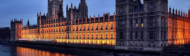
Coastal flood risk – Thames estuary and London
Most of the text below, on flood protection in the Thames Estuary, is from Lavery and Donovan (51), unless mentioned otherwise.
Thames Barrier: a response to the 1953 flood
Historically, River Thames tidal defences have been improved in response to tidal flooding disasters, the most recent of these being the devastating flood of 1953. This acted as the catalyst for construction of the current system of River Thames tidal defences. These defences, which include the Thames Barrier, provide one of the best standards of flood defence in the UK. With over 20 years of reliable operations, the Thames Barrier and associated defences have provided confidence to investors and reassurance to the people of London.
In 1954, the Waverley Committee reported on the disaster, and research and investigations commenced. To speed up the investigations and deal with the inertia caused by ‘competing theories’, the government Chief Scientist Sir Herman Bondi was asked to adjudicate. The Bondi Report of 1966 recommended that the best solution was a tidal surge barrier and raising the height of the river bank, backed up with a good system of flood warnings. In 1972, legislation was provided through the Thames Barrier and Flood Prevention Act, which allowed the construction of the Thames Barrier and associated defences to commence.
The Thames Barrier became operational in 1982 and was used for the first time to protect London from flooding on 1 February 1983, incidentally this day was the 30th anniversary of the 1953 flood. Since then, the operations of the Thames Barrier and associated defences have been reliable.
On average, the Thames Barrier is required to close around 3.3 times per year to prevent tidal flooding. Since the first flood defence closure in 1983, the Thames Barrier has been closed on 88 occasions to prevent flooding. … these closures may be classified as ‘surge dominated’ or ‘fluvial dominated’ closures. … It was anticipated that there would be an estimated 30 closures per year by the year 2030. The trend for surge dominated closures appears to be following the prediction but the fluvial dominated closures are more erratic.
Current scenarios for accelerated sea level, increases to tidal surge and wind driven wave extremes and frequencies were not accounted for in the design of the barrier, although there were generous allowances for mean sea level rises. Although there is uncertainty in developing scenarios for these parameters, it has been suggested that extreme sea levels in the 2080s could be 1.2 m higher than current extremes (52).
High water levels in the past
London has had a long history of flooding; the Anglo-Saxon Chronicles record a surge tide in 1099 on “the first day of the full moon”, in 1236 the River Thames was reported to be overflowing, “and in the great Place of Westminster men did row werries in the midst of the hall”(53).There is documented evidence of rising sea levels over the past 350 years and these records show that exceptional high water levels are becoming more frequent.
In January 1928, the last time central London suffered serious tidal flooding, 14 people drowned. In February 1953, 58 people drowned on Canvey Island. Other exceptionally high tides occurred in 1965, 1978 and 1996—this last exceptional tide being controlled by the Thames Barrier which became operational in 1982. Of these high water levels, four are known to have had a large surge component and are associated with four of the six highest water levels recorded (1928, 1953, 1965 and 1978).
The highest water level was recorded in 1953 when flooding did not reach central London although there was considerable flooding further downstream. 100 of the 300 people who died lived in the lower reach of the Thames Estuary. Over 25,000 properties were damaged, 30,000 people evacuated and 180,000 acres of land flooded along the East coast during this event. In London, the defences in place at the time held with a few minor exceptions. The maximum surge component in 1953 was 2.88 m (reducing to approximately 1 m in central London), but had it occurred at the time of predicted high water, the water level at Southend could have been 0.88 m higher. The predicted tide was also more than 0.3 m below the mean spring tide level (54).
The 1953 flood was a catastrophe for the east coast of England and the lower Thames Estuary with over 300 deaths, but it could have been considerably worse if the ‘worst case’ scenario for 1953 had occurred. The current defence system was designed to defend against the worst case scenario for 1953.
In addition to the risk of flooding from a surge tide, a combination of events in the upper reaches of the tidal Thames could also create a significant flood risk. These events occur when fluvial river flow is high during periods of large nonsurge spring tides. Such events may then require the Thames Barrier to be closed to reduce the chance of flooding as the tide comes in (particularly if it has a high or near high water surge component). These conditions were experienced in the winter of 2000/2001, when there were 24 closures of the Thames Barrier. In January 2003, there were 19 closures of the Thames Barrier in one month alone, most of the closures being required to minimize the risk of flooding at the fluvial/tidal limit.
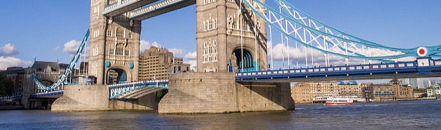
Present flood protection Thames Barrier, Walls and Embankments
The primary threat of flooding from the tidal River Thames is from North Sea surge, although high fluvial flows in the River Thames catchment and wind generated surge effects from the English Channel can exacerbate tidal flood conditions.
The Thames Barrier was inaugurated by the Queen in 1983, three decades on from the 1953 floods. The Thames Barrier and its associated defences are engineered to protect London from a tidal surge of up to 7 m, which has a probability of 1 in 2000 years at the current time. The Barrier will stop meeting its original design standards in 2030 due to rising sea levels (32); the Barrier was designed to protect London from a 1 in 1000 year combined tidal/fluvial event in the year 2030. This included an allowance for a sea level rise of 8 mm per year until 2030.
Five other barriers (Barking, Benfleet, Dartford, Easthaven and Fobbing Horse) and two flood gates at the entrances to the Royal and Tilbury Docks were also constructed, together with strengthening and raising of downstream defences to accommodate the increased water levels expected.
Together, an estimated 1.25 million people living and working in the tidal floodplainare protected from tidal flooding by the Thames Barrier, 337 km of flood walls and embankments, the aforementioned additional major tidal barriers, 36 major industrial flood gates and over 400 minor moveable structures. The walls and embankments are located on more than 3,000 privately and individually owned lengths of river frontage (53).
The current standard of River Thames tidal defence is based on calculations made during the design of the Thames Barrier during the 1960s and 1970s. The defence levels are based on providing a combined tidal and fluvial standard of 1 : 1000 (or 0.1% risk of flooding in any one year) in the year 2030, with this including an allowance for annual sea-level rise (relative to land) of 8 mm/year.
The Barrier will protect London against the 1,000 year flood until 2030, but it will have to be raised more often. Between its opening in 1982 and August 2001, it was raised 63 times. By 2030, due to sea level rise and other factors, it has been estimated that it will need to be raised 30 times a year on average (55). By the 2050s, a 34 cm rise in sea level at Sheerness changes the 1 in 1000 year level, to a 1 in 200 year event (56). By 2100, it is estimated that the Thames Barrier will need to close about 200 times per year to protect London from tidal flooding (57).
Property and population at risk
Within the strategy area, there are approximately 500,000 properties at risk from flooding, including 420,000 properties at risk from tidal flooding throughout the estuary and 85,000 at risk from fluvial flooding in London. The estimated value of this property is £80 billion and houses 1.25 million people—approximately one-sixth of London’s population: this represents a significant proportion of the total flood risk property in England and Wales. Other assets within the floodplain include 400 schools, 16 hospitals, eight power stations, dozens of industrial estates, the city airport, 30 mainline railway stations and 38 underground and Docklands Light Railway stations, with this including most of the central part of the underground network.
The value of property within the flood risk area is in excess of £80 billion and does not include any valuation of infrastructure such as freshwater and sewerage systems, power, gas, telephone and data services installations. If these were to flood, the consequent impact on businesses located in and around the floodplain will affect not just the UK’s economy but could have international repercussions. In addition, there are around four million jobs in the rest of the UK that are dependent on London’s demand for goods and services (58).
The total cost of a flood throughout the Thames Estuary, including assets in Anglian, Southern and Thames regions of the Environment Agency, has been estimated at £40 billion (59). Othercalculations suggested that a major flood in this area could cost between £12-16 billion, with about £4-5 billion coming from the new developments if precautions are not taken in the new developments(32). £109 billion of assets are estimated to be potentially at risk in the Thames region alone (59). Indirect costs may add a further £3–11 billion of costs as indirectconsequences of serious flooding can also be expected to be significant, although they generally do not exceed more than 10% of the direct flood losses (58).
If the 1953 storm was repeated now, it could result in insured losses of over ₤20 billion (57). London is ranked the ninth most vulnerable megacity on a risk register of natural hazards for the worlds’ 50 megacities (80). All of London’s natural hazards are weather-related; the probability of all these risks is predicted to increase as the climate changes (79).
Flood risk: probability times consequences
Flood risk is defined as probability times consequences (damage) and is expressed as expected annual damage. For the present day for the Thames Estuary this value is approximately £3.5 million (53,60). This relatively low figure serves to demonstrate how effective the current integrated system of barriers and linear defences are at managing risk to the Thames Estuary floodplain. The remaining risk is concentrated in those areas of the lower estuary where the defences standard is lower than the >1:1000 year protection afforded to the rest of the estuary and the tributaries.
Looking at the TE2100 High+ scenario, in the year 2100 expected annual damage is estimated to be £255.5 million (53). Even with a medium–high climate-change scenario, the annual damage risk increases to only £50 million in 2100 if current defences are maintained (60). Approximately 70% of London’s flood risk stems from only 1% of its defences, showing that focused intervention can yield significant benefits (60).
‘Thames Gateway’
Today, in the early part of the twenty-first century, London continues to expand, and substantial growth is planned through the UK government’s regeneration initiative, the ‘Thames Gateway’. London is thus moving to the east, with extensive residential and commercial property being built in the natural Thames tidal flood-plain.
These new developments will fundamentally change the developed footprint in the Thames Estuary flood-plain, and will be in place for at least the next 50–100 years. This presents the Environment Agency with a dual challenge of planning defences for the next generation while ensuring that the right decisions are made now concerning the nature and location of new buildings in the tidal flood-plain (see also 53).
The proposed ‘Thames Gateway’ regeneration initiative is one of the government’s major regeneration proposals which aims to provide 120,000 new houses to be constructed within the next 15–20 years. This equates to building the equivalent of 5% of the homes that currently exist in the whole of Londonin the next decade (32). These developments, should they go ahead in full, would add a further £1 billion to the potential flood damage. This increased flood hazard potential would be concentrated within the zones of change where the potential average annual damage, taking account of the relatively high levels of protection, would rise by up to 80%.
‘Thames Estuary 2100’ (TE2100)
Through its ‘Thames Estuary 2100’ project, the Environment Agency is developing a long-term strategy for flood risk management in the estuary. The overarching aim of the project is to develop a Flood Risk Management Plan for London and the Thames Estuary that is risk based, sustainable, takes into account the existing and future assets, is inclusive of all the stakeholders and addresses the issues in the context of the climate and socioeconomic scenarios that could develop over the next 100 years. TE2100 is factoring in the need to make the infrastructure and communities in the Thames Estuary more resilient to flood risk.
The final plan, due in 2009, will provide an integrated approach and vision for flood risk management in the Thames Estuary for the next 100 years. It will highlight the need to make space for water where appropriate, increase the resilience of the communities at risk, and provide adaptable options for future investment in flood risk management that will cope with a range of possible changes threatened by climate change (53).
Implementation of major construction works on the River Thames could commence from around 2015, may cost as much as £4 billion, and will be carried out over a 20 year period. Alternatively, it may be decided that minimum works are undertaken to provide security and major investment is delayed until uncertainties over climate change have abated (see also 53).
It took 30 years to plan and build the current system of defences following the 1953 flood. With less than 30 years remaining before the River Thames tidal defences design standard is reached in 2030, it is important to commence planning for the next generation of defences for London and the Thames Estuary now. With the future sustainability of London and the highly developed Thames corridor at stake, there is a compelling case for production of a long-term strategy without delay.
The Thames Estuary is vulnerable to three types of flooding: the inundation of flood-plains by river water, local flooding when the drainage network is overwhelmed by intense rain storms and tidal surges. Sea level is rising relative to the land as a result of global warming and the downward land tilt associated with post-glacial recovery. The latest UK climate scenarios suggest extremes will change, in particular, the frequency and magnitude of more intense rainfall. The amount of change will depend on the greenhouse gases emitted, but by the 2080s seasons will have changed and become more intense and many coastal locations are likely to experience extreme water levels more frequently.
For some UK East Coast locations, such as the Thames Estuary, current extreme sea levels could occur between 10 and 20 times more frequently than they do now with the levels becoming increasingly extreme. Sea levels will continue to rise. These changes will vary from a few centimetres in the northwest of England to up to 90 cm around London under the highest emission scenario (52). Sea-level rises and tidal surges will be serious problems, although the extent is as yet unknown.
The Thames Barrier is just one part of the overall Thames tidal defences system—albeit the single largest structure. All major structures are being examined for robustness—that they can last the test of time given an uncertain future—and sustainability under climate change and other changing environment scenarios. Early indications are that, subject to appropriate modifications, the useful life of the Thames Barrier could be extended by a further 100 years.
An important element of the developing flood risk strategy for London and the tidal Thames is the promotion of sensible decisions on flood resilient construction, backed up by an effective flood warning system. … As part of the move from ‘flood defence’ to ‘flood risk management’, the Agency is investigating the practicality of flood management options within the floodplain hinterland rather than restricting the options to flood defence along the river’s edge.
As well as structural changes to the system, such as raising of the existing defences, other promising options such as strategic flood storage on the areas of marsh and low lying metropolitan open land that fall between the Thames Barrier and Tilbury have been examined. Use of these areas for tidal flood storage during extreme events (with a probability of up to 1 percent in any year that the area is needed) could reduce flood levels by 0.8 metres in the River Thames. This could “buy” an additional 50 to 70 years above the originally quoted 2030 design standard of the Thames Barrier and associated defences, if the current DEFRA climate change guidance is assumed (53).
The final tidal flood risk management plan for the Thames Estuary will be flexible to ensure that it can be adapted if sea levels rise faster, or storm surges become more intense than anticipated(4). Preliminary findings show that the Thames Barrier, with some adaptation, will continue to provide protection through to the end of the century.
An extremely dramatic, but highly unlikely scenario
Dawson et al. (61) present an extremely dramatic, but highly unlikely scenario for the Thames Estuary.
If Antarctica were a positive contribution to SLR during the 21st century, the rise in sea level could be larger than scenarios generally assume. In the extreme, the total collapse of the Western Antarctic Ice Sheet (WAIS) would result in a 5–6 m sea level rise. The probability and associated time-scale for such a collapse are highly uncertain. Dawson et al. (61) presented an analysis of possible impacts and potential responses of SLR scenarios in the range of 1–5 m over the next 100 years for the Thames estuary. Their analysis is based on a two-dimensional hydrodynamic storm surge model of the Thames estuary.
Whilst the direct damage to infrastructure would undoubtedly be large, the potential impact on the London and UK economy in the long term might be disastrous. The interruption to transport and communication links and the loss of working hours and trading, etc. during the inundation and subsequent clean-up could run into billions of pounds sterling. Given the dynamic nature of financial businesses located in London they might rapidly relocate to other financial districts in Europe, such as Frankfurt, that are perceived to be ‘safer’ in the long term. The international nature of business would mean the impact of a serious flood event is likely to have global economic repercussions (62).
Dawson et al. state that their model results highlight the vulnerability of the Thames estuary floodplain to even 1 m net sea level rise. In order to respond to these poorly defined risks effectively, future flood management strategies need to be robust and consist of a portfolio of possible adaptation options so that they can respond to a range of events, including those induced by abrupt or large climate change. In the case of London, it can be argued that this range extends to a 2 m sea level rise during the 21st century (63).
This becomes increasingly important when the rate of change is considered. Should 1m net sea level rise occur over a long duration, society is likely to be able to respond on an ad hoc basis. However, rapid change such as the partial or complete collapse of the WAIS would force a step change in the rate of SLR. Based on the experience of constructing the current Thames Barrier and the Eastern Scheldt Barrier in the Netherlands, it is unlikely that a new outer barrier could be designed and built in less than 20 years. Indeed, even an upgrade of the current defence system is likely to require a similar timescale.
In a scenario of 5 m sea level rise over 100 years, even including the proposed upgrade of 1 m to the defence system, within 40 years central London would be threatened by the 1 in 10 year flood. Dawson et al. conclude that future decisions on flood management need to be flexible in the long term in order to effectively manage the great uncertainty in our understanding of human and climate related processes.
Economic impacts of sea level rise for Europe
The direct and indirect costs of sea level rise for Europe have been modelled for a range of sea level rise scenarios for the 2020s and 2080s (93). The results show:
- First, sea-level rise has negative economic effects but these effects are not particularly dramatic. In absolute terms, optimal coastal defence can be extremely costly. However, on an annual basis, and compared to national GDP, these costs are quite small. On a relative basis, the highest value is represented by the 0.2% of GDP in Estonia in 2085.
- Second, the impact of sea-level rise is not confined to the coastal zone and sea-level rise indeed affects landlocked countries as well. Because of international trade, countries that have relatively small direct impacts of sea-level rise, and even landlocked countries such as Austria, gain in competitiveness.
- Third, adaptation is crucial to keep the negative impacts of sea-level rise at an acceptable level. This may well imply that some European countries will need to adopt a coastal zone management policy that is more integrated and more forward looking than is currently the case.
Adaptation strategy - Overview
Adaptation options can be divided into spatial planning (pro-action), infrastructure (prevention) and contingency planning (preparation, response and recovery) (64). These three policy lines address flood risk management in different ways:
- Measurements in spatial planning are meant to direct flood risk away from populated areas and design these areas such that an occasional flood causes little harm.
- Infrastructure measures reduce flood risk by improving the level of flood protection and thus reducing the probability of a flood.
- Contingency planning focuses on being prepared for a flood by working out emergency measures, evacuation procedures, recovery programmes etc.
Adaptation strategy - Spatial planning
Long time scale
Longer-term strategies are needed, looking 50 and 100 years ahead, to ensure that development and infrastructure plans are resilient, and that vulnerable activities are moved over time to safer locations (6). Increased collaboration between governmental bodies and insurance companies could provide an economic impetus to the planning of sustainable developments in the floodplain (65). Other options are promoting flood-proofing of building materials and design, the use/restoration of natural ecosystem buffers and floodplains (66), and avoiding new development being located in areas at risk from sea level rise and storm surges (16).
UK Government’s policy
When considering whether investments in flood-prone areas should be allowed or not, UK Government’s policy discriminates between three zones based on their inundation probability (Table below: ‘exception’ refers to investments that should be subjected to an exception test to find out whether they should be allowed or not) (94):
|
Zone 1: Annual fluvial or coastal flood probability < 0.1% |
Zone 2: Annual fluvial flood probability 0.1-1% Annual coastal flood probability 0.1-0.5% |
Zone 3a: Annual fluvial flood probability >1% Annual coastal flood probability >0.5% |
Zone3b: Functional floodplain: land where water has to flow or be stored in times of flood |
|
|
Essential infrastructure (e.g. evacuation routes and strategic utility infrastructure) |
Appropriate | Appropriate | Exception | Exception |
|
Water compatible (e.g. docks, flood control, and water transmission) |
Appropriate | Appropriate | Appropriate | Appropriate |
|
Highly vulnerable (e.g. emergency services, caravans, and hazardous materials) |
Appropriate | Exception | Should not be permitted | Should not be permitted |
|
More vulnerable (e.g. hospitals, care homes, and hotels) |
Appropriate | Appropriate | Exception | Should not be permitted |
|
Less vulnerable (e.g. shops, offices, and water treatment) |
Appropriate | Appropriate | Appropriate | Should not be permitted |
Spatial planning combined with infrastructure measures and contingency planning
Because of the variations in geology, meteorology, hydrology and culture in different localities and different countries, quite different concepts, policies and practical arrangements are being tested to deal with increasing changes of fluvial and coastal flooding (64,67).
In the Netherlands, the state passed a law that no land would be lost as a result of sea level rises. Thus, flood protection policy in the Netherlands is based on infrastructure measures (prevention, 64). In the UK, however, pragmatic decisions have had to be made in which some areas are ‘defended’ and others are allowed to erode or be submerged. Thus, flood protection policy in the UK is a combination of spatial planning and infrastructure measures, and contingency planning. This marked divergence in policy is based on both cultural and scientific factors. It is possible to defend Dutch beaches by dredging the offshore and raising dykes—‘replenishment’—but this is not possible along the low lying eastern shore of England because of the low cohesiveness of the muddy sediment. Hard defences or managed retreat appear to be the only options (67).
Managed coastal re-alignment
An example of adaptation in practice is the Essex Wildlife Trust, which has undertaken the largest coastal realignment project in Europe, converting over 84 hectares of arable farmland into salt marsh and grassland, to provide sustainable sea defences (68).The Abbott’s Hall estate in this area has been purchased by the Essex Wildlife Trust with funding from WWF-UK. The estate has been protected by a sea wall for centuries, but the low-grade agricultural land made it hard to justify the continued expenditure on sea defences. Mud flats and salt marshes act to absorb energy from incoming waves, so dampening the effect they have further inland. Sacrificing the poorly used land to the sea should help to prevent surges in the tide flowing up the neighbouring estuaries, which could easily damage local towns (69).
"Managed re-alignment" is a possible response to the potential loss of coastal mudflats and salt marshes, resulting in the creation of new habitat by allowing inundation of low-lying coastal land, sometimes requiring the breaching of sea defences to allow inland movement of water. Experience in several parts of the UK suggests that inundated areas of coastal grassland are colonised rapidly by salt marsh. In Scotland, where coastal landowners are responsible for the upkeep of sea defences, this may be a cheaper option than upgrading them to cope with rising sea level, as well as ensuring the continued availability of wildlife habitat. Agri-environment payments are available to farmers to encourage the conversion of agricultural land to salt marsh (46).
Adaptation strategy - Infrastructure
DEFRA concluded that current standards of defence reduce flood risk (annual average damages) in England and Wales to approximately ₤0,8 billion/year. Accommodating climate change is likely to require a further increase in investment of between 10% and 20% over and above that required to meet indicative standards under present day conditions (70).
For the United Kingdom, it has been estimated that £22–£75 billion of new engineering works will be required by 2080 to implement a portfolio of responses to managing river and coastal flood risk in the UK, with an annual expenditure of £700 million to £1.1 billion compared with approximately £500 million at the present time(71). The capital cost of the coastal engineering works is estimated to be between £12 and £40 billion(47). Government funding of flood management, however, has remained almost flat since 2005 and is now falling in real terms (6).
Crichton (70) reports that many sea defences in England built, or rebuilt since the 1953 storm are reaching the end of their design life; due to lack of adequate maintenance 1,232 defence structures could be at risk of failure in the type of storm we can expect on average every 50 years (72). The Association of British Insurers (6) reports that the minimum cost of improving coastal flood defences on the East Coast of England and in the Thames estuary to maintain acceptable levels of risk on the East Coast alone would be £2.4 - 4 billion for the Thames Barrier and central London, £1.6 - 2 billion for the tidal Thames east of the Barrier, and £2.1 - 2.6 billion for the other East Coast communities from Ramsgate to Hull.
Without allowance for accommodating the predicted impacts of climate change within defence provision the economic impacts associated with flooding could increase significantly, with flood risk (annual average damages) increasing in fluvial areas by approximately 50% and in excess of 200% on the coast by the year 2050. To allow for anticipated climate change over the next 50 years, an overall increase of between 35 and 85% in flood defence spending would be required (73).
The report of DEFRA offered two alternatives: increase spending by up to 85% now, or concentrate spending on selected areas, in effect abandoning less populated areas to the risk of repeated floods (“managed retreat”, or “managed realignment”, 70). Shoreline Management Plans (SMPs) explore the 4 main options for shoreline management: hold the existing line, advance the existing line, retreat the line, do nothing.
The Shoreline Management Plans are working documents which look forward at least 50 years and are reviewed every 5 years. Farrar and Vaze (20) report that since 1991, the guidelines for global warming and land level adjustment have been to allow for 5 mm/year relative sea level rise in the design of coastal defences in Wales (6 mm sea level rise per year for England and Wales, according to (69)). They state that plans are often thrown into disarray by particular events, so tend to be reactive. The plans generally aim at flood protection for a 1 in 100 year flood event and a 1 in 200 year event on the coast where it is economically justified (20).
An example of an area where “managed retreat”, or in fact large-scale abandonment of a prime agricultural area, would seem likely, is the Fens. In this area the interaction of sea-level rise, increased river floods and subsidence could lead to severe flood impacts (74). In East Anglia, sea-level rise appears to threaten existing salt marshes. In some areasover half the existing stock of salt marsh could be lost by the 2050s (74). These losses will exacerbate the increase in coastal flood risk already described. Taking account of both managed realignment, and/or possible coastal abandonment of low value areas that are flooded frequently, the net effect on the stock of salt marsh habitats is likely to be stability or even a gain in area. Salt marsh gains come largely at the expense of the loss of coastal grazing marsh, which is expected, to decline in area under all climate change scenarios. Adaptation options are limited, as there are limited opportunities to create replacement habitat within the coastal zone (74).
Examples of areas that need continuous protection are not just urbanized areas. Also tourist resorts that have been developed in the past in the sand dune and beach areas (8) and nuclear energy plants on the coast (16) will require continued coastal defence.
Coastal defences may serve as a protection against erosion, against flooding, or both. About 30% of the Welsh coastline, for instance, is protected by some 380 km of artificial coastal defences. 240 km protect primarily against erosion (coastal protection) and 140 km protect primarily against flooding (sea defence) based on flood walls and embankments. Some 83 km of coastal defences which protect against erosion have a secondary flood defence function against wave over-topping. As a result, the total length of sea defences against flooding is 223 km (20).
The division of responsibilities presents some confusion to the public in knowing who is responsible for flood and coastal defence in their areas. Better coordination of information would help to clarify the position.
- In England and Wales, the Environment Agency is responsible for all flood defence matters through the Water Resources Act 1991. The Agency exercises general supervision over all matters relating to flood defence and undertakes measures to reduce the risks of flooding from the sea and designated main rivers.
- On coast protection and flood defence on non-main rivers, powers rest with local authorities except in specified districts with special drainage needs, where Internal Drainage Boards have powers for flood defence and sea defence.
- In many cases defences on private land are maintained by the Environment Agency and local authorities.
- National authorities are responsible for the policy framework on flood defence and coastal protection, and for coordinating the response to river, sea and tidal flooding emergencies. They also provide grants to operating authorities for new and improved flood warning systems and flood and coastal defence measures (20).
Significant market opportunities exist for many business sectors to develop climate-proof products and services which reduce climate impacts and increase adaptability. Commercial opportunities may include the development of “flood proof” infrastructure, including engineered flood defences, and installations similar to the Thames Barrier to accommodate higher storm surges and tides (45).
Adaptation strategy - Contingency planning
One way to adapt to the consequences of climate change is to be prepared for disasters. Options for adaptation, therefore, include improving flood forecasting, raising awareness, drawing up contingency plans and taking the necessary measures such as shelters on higher ground (75).
In Canvey Island, Essex, the elevated refuge constructed following the loss of life in the 1953 coastal floods has never had to be used. However, their local government representatives reminded the Royal Society meeting in May 2003 that this refuge is well maintained and, just as importantly, everyone knows about it (67). The use of refuges illustrates a critical point for all natural disasters: information should be of the highest quality and always based on the latest techniques. Technology, and the wide involvement of society, are both necessary for planning and warning over days to decades to reduce the vulnerability of communities and to ensure the most effective rescue and remedial measures following any flood event (76).
Disaster prevention, preparedness, response and recovery should become even more of a priority for Member States (77).
Adaptation strategy - London
To reduce and manage current and future flood risk in London, the Mayor will work with partners to (79):
- improve the understanding of flood risk in London and how climate change will alter the risks, to improve the ability to manage flood risk;
- reduce flood risk to the most critical assets and vulnerable communities, to target the greatest effort on London’s most vulnerable assets;
- raise public awareness of flooding and individual and community capacity to cope and recover from a flood, to improve London’s resilience to flood events.
Options have been investigated for the future of protecting London from flooding from the sea. Economic analyses have shown that improving the existing flood defences and, in 2070, constructing a new Thames Barrier downstream from the existing one are the ‘‘front runner’’ options for tackling the increase in flood risk that is anticipated in the future (97).
The very high standard of protection now in the Thames Estuary, and the robustness of the existing flood defences assets, mean that major new interventions will not be needed for some time (i.e. until 2070). Besides, improving the standard of protection now to meet the current level of risk is not cost-efficient. The extra benefit gained is generally not worth its costs, until climate and socio-economic change begin to alter that situation by creating additional risk from 2050 and towards 2070. There is time, therefore, to monitor the situation and carefully plan the adaptive measures that are needed now and in the medium term (97).
Adaptation strategies - The costs of adaptation
Both the risk of sea-level rise and the costs of adaptation to sea-level rise in the European Union have been estimated for 2100 compared with 2000 (96). Model calculations have been made based on the IPCC SRES A2 and B1 scenarios. In these projections both flooding due to sea-level rise near the coast and the backwater effect of sea level rise on the rivers have been included. Salinity intrusion into coastal aquifers has not been included, only salt water intrusion into the rivers. Changes in storm frequency and intensity have not been considered; the present storm surge characteristics are simply displaced upwards with the rising sea level following 20th century observations. The assessment is based on national estimates of GDP.
The projections show that without adaptation (no further raising of the dikes and no beach nourishments), the number of people affected annually by coastal flooding would be 20 (B1 scenario) to 70 (A2 scenario) times higher in 2100 than in 2000. This is about 0.05 - 0.13% of the population of the 27 EU countries in 2010 (96).
Without adaptation, damage costs would increase roughly by a factor of 5 during the century under both scenarios, up to US$ 17×109 in 2100. Total damage costs would amount to roughly 0.04% of GDP of the 27 EU countries in 2100 under both scenarios. Damage costs relative to national GDP would be highest in the Netherlands (0.3% in 2100 under A2). For all other countries relative damage costs do not exceed 0.1% of GDP under both scenarios (96).
Adaptation (raising dikes and beach nourishments in response to sea level rise) would strongly reduce the number of people flooded by factors of 110 to 288 and total damage costs by factors of 7 to 9. In 2100 adaptation costs are projected to be US$ 3.5×10⁹ under A2 and 2.6×10⁹ under B1. Relative to GDP, annual adaptation costs constitute 0.005 % of GDP under B1 and 0.009% under A2 in 2100. Adaptation costs relative to GDP are highest for Estonia (0.16% under A2) and Ireland (0.05% under A2). These results suggest that adaptation measures to sea-level rise are beneficial and affordable, and will be widely applied throughout the European Union (96).
References
The references below are cited in full in a separate map 'References'. Please click here if you are looking for the full references for the United Kingdom.
- Masselink and Hughes (2003), in: Lowe and Gregory ( 2005)
- Shennan (1989), in: Low and Gregory (2005)
- Jenkins et al. (2009)
- Department of Energy and Climate Change of the United Kingdom (2009)
- Lowe and Gregory (2005)
- Association of British Insurers (2006)
- Hulme (1999), in: Farrar and Vaze (2000)
- Kersey et al. (2000)
- Association of British Insurers (2006), from: Update to estimates of net sea-level change for Great Britain (2006) - www.ukcip.org.uk
- Hulme et al. (2002), in: Hall et al. (2006)
- Lowe and Gregory (2005)
- Nakicenovic et al. (2000), in: Lowe and Gregory (2005)
- McDonald 2002, in: Lowe and Gregory (2005)
- Gregory et al. (2001), in: Lowe and Gregory (2005)
- Jenkins et al. (2009)
- Land Use Consultants, CAG Consultants and SQW Limited (2003b)
- see: Climate change scenarios for the United Kingdom: the UKCIP02 Scientific report - www.ukcip.org.uk, in: Lowe and Gregory (2005)
- see: Jason Lowe, Hadley Centre, Met Office, pers. comms., in: Lowe and Gregory (2005)
- CCIRG (1996), in: Farrar and Vaze (2000)
- Farrar and Vaze (2000)
- Tsimplis et al. (2005)
- Woodworth and Blackman (2004), in: Tsimplis et al. (2005)
- Hurrell (1996), in: Tsimplis et al. (2005)
- Hilmer and Jung (2000), in: Tsimplis et al. (2005)
- Paeth et al. (1999); Ulbrich and Christoph (1999), both in: Tsimplis et al. (2005)
- Wakelin et al. (2003); Woolf et al. (2003b), both in: Tsimplis et al. (2005)
- Jevrejeva et al. (2005), in: Tsimplis et al. (2005)
- Woodworth and Blackman (2002), in: Tsimplis et al. (2005)
- Woolf et al. (2002, 2003a), in: Tsimplis et al. (2005)
- Wang and Swail (2001), in: Tsimplis et al. (2005)
- Latif (2001), in: Tsimplis et al. (2005)
- Greater London Authority (2005)
- Hulme and Jenkins (1998), in: Kersey et al. (2000)
- Pitt Review (2008)
- McRobie et al. (2005)
- West and Gawith (2005)
- www.thamesweb.com
- Association of British Insurers (2006)
- Holman et al. (2007)
- National appraisal of assets at risk from flooding and coastal erosion, including the potential impact of climate change, DEFRA (July 2001), in: Land Use Consultants, CAG Consultants and SQW Limited (2003b)
- West and Gawith (2005)
- Eurosion (2004), in: Hall et al. (2006)
- Foresight (2004)
- Halcrow (2001), in: Hall et al. (2006)
- C-CLIF and GEMRU (2003)
- Kerr et al. (1999)
- Hall et al. (2006)
- DEFRA (2004), in: McRobie et al. (2005)
- Jorissen et al. (2000), in: McRobie et al. (2005)
- Muir Wood et al. (2005)
- Lavery and Donovan (2005)
- Hulme et al. (2002), in: Lavery and Donovan (2005)
- Reeder and Tarrant (2007)
- Wallingford (2002), in: Lavery and Donovan (2005)
- Environment Agency (2001), in: Crichton (2003)
- Wade et al. (2001),in: London Climate Change Partnership (2002)
- Environment Agency (2001b),in: London Climate Change Partnership (2002)
- FHRC (2002), in: Lavery and Donovan (2005)
- Atkins (2002), in: Lavery and Donovan (2005)
- Gouldby et al. (2008)
- Dawson et al. (2005)
- Munich Re (2004), in: Dawson et al. (2005)
- Arnell et al.(2005), in: Dawson et al. (2005)
- Ten Brinke et al. (2008)
- ABI (2002), in: London Climate Change Partnership (2002)
- London Climate Change Partnership (2002)
- Hunt (2005)
- DEFRA (2006)
- Land Use Consultants, CAG Consultants and SQW Limited (2003a)
- Crichton (2005)
- Evans et al. (2004), in: McRobie et al. (2005)
- Crichton and Mounsey (1997)
- Crichton (2003), based on: National Appraisal of Assets at Risk from Flooding and Coastal Erosion, including the potential impact of climate change, DEFRA (July 2001)
- Holman et al. (2002)
- Ten Brinke et al. (2010)
- Parker (2004), in: Hunt (2005)
- Commission of the European Communities: Green paper (2007)
- UKCIP09 UL Climate Projections 09, in: Northern Ireland Environment Agency (2009?)
- Greater London Authority (2010)
- Munich Re (2004), in: Greater London Authority (2010)
- European Commission (2009), in: Met Office (2011)
- Hanson et al. (2010); Richards and Nicholls (2009), both in: Met Office (2011)
- Met Office (2011)
- Dong et al. (2011), in: IPCC (2012)
- IPCC (2012)
- Debernard and Roed (2008), in: IPCC (2012)
- Bindoff et al. (2007), in: IPCC (2012)
- Church and White (2011), in: IPCC (2012)
- Velicogna (2009); Rignot et al. (2011); Sørensen et al. (2011), all in: IPCC (2012)
- Marcos et al. (2009); Haigh et al. (2010); Menendez and Woodworth (2010), all in: IPCC (2012)
- Leake et al. (2007), in: IPCC (2012)
- Woth (2005)
- Bosello et al. (2012)
- CLG (2006), in: Dawson et al. (2011)
- Dawson et al. (2011)
- Hinkel et al. (2010)
- Penning-Rowsell et al. (2013)
- Huntingford et al. (2014)
- Hunter (2012), in: Huntingford et al. (2014)
- Pardaens et al. (2011), in: Huntingford et al. (2014)
- Cazenave et al. (2014)
- IPCC (2014)
- Watson et al. (2015)
- Yi et al. (2015)
- Church et al. (2013), in: Watson et al. (2015)
- Shepherd et al. (2012), in: Watson et al. (2015)
- Church et al. (2013), in: Watson et al. (2015)
- Environment Agency (2013), in: Niemeyer et al. (2016)
- DEFRA (2011), in: Niemeyer et al. (2016)
- Schrum et al. (2016)
- Vousdoukas et al. (2016)
- Debernard and Røed (2008); Gaslikova et al. (2013); Howard et al. (2014); Lowe et al. (2009); Woth et al. (2006), all in: Vousdoukas et al. (2016)
- Rennie and Hansom (2011)


