
Portugal
Forest fires Portugal
Portugal stands out globally as the country with the highest percentage of its forestry land lost to wildfires between 2001 and 2021, about 13% (47).
What conditions cause large wildfires in Portugal and Spain?
Short- and long-term effects
Despite being episodic events, large wildfires account for the bulk of burned area in Spain and Portugal. These wildfires, with burned areas > 500 hectares, can be characterized by the climate and weather conditions that cause them. Climatic conditions over a time scale of seasons to years determine the amount of fuel that feed these fires. Weather conditions in the days or weeks prior to the onset of a fire change the fuel moisture state of especially the fine fuel and litter, and hence their flammability. On a shorter time scale, hourly and daily meteorological variables control fire ignition and propagation (39).
Four types of large wildfires
For the Iberian Peninsula (Portugal and Spain), large wildfires during the period 2001 - 2015 have been characterized by looking at the climate and weather conditions at different time scales that coincided with these events. Knowledge on the causal relations between these conditions and the onset of large wildfires can be used for early warning and preparation. A distinction is made in four types of large wildfires, labelled: ‘heat-driven’, ‘heat wave’, ‘seasonal drought’ and ‘wind-driven' (39):
- ‘Heat-driven’ large wildfires are driven by temperature and dryness of fuels. They are associated with calm winds and sustained hot and dry conditions conducive to low fuel moisture.
- ‘Heat wave’ wildfires are also driven by temperature and dryness of fine fuels, and associated with calm winds. Contrary to the ‘heat-driven’ type, extremely high temperatures are driving these fires, causing a rapid desiccation of fine fuels and litter, whilst the moisture content of heavy fuels is not low.
- ‘Seasonal drought’ wildfires are associated with extended drought periods, leading to dry heavy fuels. For this type of wildfire, the spread of the fire is not inhibited by the presence of moist fine fuels. It is the low moisture content of the dry heavy fuels, a result of prolonged drought periods, and the wind that drive the fires.
- ‘Wind-driven’ wildfires occur on days with sudden warm conditions and very strong winds. These wildfires are especially associated with a sudden drop in relative humidity and the emergence of strong winds during the day of ignition. Temperatures over a period of 30 days prior to the fire also play a role, however.
‘Heat-driven’ wildfires seem to be the dominant type of large wildfires in Spain and Portugal. Second in importance ranks the ‘heat wave’ type. Exceptional heat and drought conditions in 2003 led to one of the worst fire seasons recorded in Portugal.
Wildfire hotspot: halfway Portugal
During the last decades, the bulk of large fires started halfway Portugal near the border with Spain. All four types of large wildfires are common there. Clearly, it is the combination of heat, drought and wind that promotes larger fires. While annual or seasonal long-term climatic variables influence fuel amount, short-term weather in the previous days or weeks changes fuel moisture state, and hourly and daily meteorological variables control fire ignition and propagation (40).
Fire-fighting strategies
This knowledge on causal factors driving large wildfires can be used for strategies to combat them. The contribution of weather factors may change throughout the landscape promoting different dominant fire spread patterns (41). Where fuel moisture content holds a leading role, fuel treatments might be promoted to diminish hazard. Where wind speed is driving fire spread then early warning systems and fire-fighting arrangement might have to be prioritized (42). The recent decadal increases in fuel load and continuity across Mediterranean landscapes (43) have led to propose shifts in management focus from suppression to fire-, fuel-managed, more resilient landscapes (44).
Vulnerabilities - Changes in the past - Mediterranean
In the last decades, there has been a noticeable increase in the number of wildfires in the Mediterranean countries (1). The total area burnt also increased in Spain (2), and in the other Mediterranean countries of the European Union (3,17). However, the increase in the total area burnt is not as sustained as the increase in the fire frequency, but there are periods of low annual area burnt punctuated with years of extraordinary fire activity, like 2003 in Portugal or 1994 in eastern Spain (4). A study on the Mediterranean region on fire trends in Portugal, Spain, southern France, Italy, and Greece in the period 1985-2011 revealed a general decreasing trend of the total annual burned area in all countries, with the exception of Portugal (34). At the national level, 35% of the municipalities in Portugal showed a positive trend (increase) of area burned and 5% revealed negative trends for the period 1980-2014 (35).
An increase in the area burnt is not necessarily related to an increase in the ignition frequency. Results from research have been reported that show that the number of ignitions had very little effect on the total area burnt. The results indicate that the total area burnt will be more or less the same despite any effort to reduce it by reducing the number of ignitions, extinguishing fires or by using prescribed burning. This annual area burnt appears to be determined by the characteristics of the vegetation (maximum biomass and rate of the accumulation of biomass) and by the meteorological characteristics (average and standard deviation of the meteorological conditions). Furthermore, reducing the number of ignitions had the perverse effect of increasing the proportion of area burnt in large fires: there were less fires, but these were larger (4).
The main determinant of the fire regime is probably the accumulation of fuel in the vegetation. Processes that allow the natural accumulation of fuel, like reducing the number of ignitions or increasing the fire fighting capacity, permit the creation of continuous areas with a high fuel load, which will burn under adverse meteorological conditions and produce large fires. On the contrary, processes that eliminate patches of fuel, like a high number of ignitions, non-fire suppression, or prescribed burning, create a patchy mosaic in the vegetation that can behave as fuel-breaks under some circumstances, and reduce the extension of some fires that, otherwise, would become large fires (4).
Vulnerabilities - Changes in the past - Portugal
A new era of forest fires since the 1980s
Before the 1980s fires in mainland Portugal had never reached 10,000 ha of burned area in a single occurrence, according to available data on forest fires. In the last decade two forest fires occurred that covered an area of over 20,000 ha (19). The number of large forest fires in Portugal is increasing, and the extent of these fires is increasing as well. According to scientists a new era of forest fires has begun in Portugal, and it started somewhere around 1987 (20).
Climate change can be an important driver of greater fire activity (21,22), but it’s not the only one. In fact, in southern Europe climate change seems to be a far less important driver than socio-economic factors and changes in land use (22). Important socio-economic factors are depopulation and ageing of rural populace. Important changes in land use are agricultural abandonment, expansion of highly flammable tree species, and renewed growth of woody vegetation in cleared landscapes. Also, the success in suppressing small and medium size fires is producing landscapes with higher flammability and more fuel loads that contribute to larger and more severe forest fires (23).
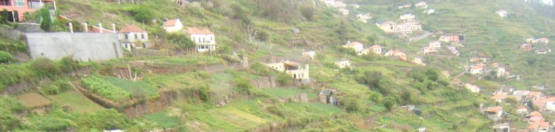
Degraded areas become more likely to be affected by fires. These areas are characterized by herbaceous plant and shrubs, which are extremely susceptible to fire because of their low moisture content and flammable fuel load (24). This is a vicious cycle. The rural exodus led to an increase in abandoned farmlands and growth of woody vegetation. This soil degradation as a result leads to more and larger fires that consequently further degrade the soil. Many of these rural areas became liable to the occurrence of devastating fires as a result of the high quantities of biomass accumulated over the years, which could fuel catastrophic fires during the summer months (25). The proportion of uncultivated land, due to the population exodus from rural areas to coastal cities and other European countries since the 1950s, was the most important factor affecting burnt areas in Portugal (26).
During the summer of 2003 more than 25,000 fires were recorded in Portugal, Spain, Italy, France, Austria, Finland, Denmark and Ireland. The estimation of EU forest areas destroyed reached 647,069 hectares (5). Portugal was the worst hit, Spain came second. This was by far the worst forest fire season that Portugal had faced in the last 23 years. In October 2003, the financial impact estimated by Portugal exceeded 1 billion euros (6). It should be stressed that Portugal and the northwestern provinces of Spain presented the largest number of fires in Europe in 2003 (nearly 50%). These fires were directly responsible, among other consequences, for the loss of 21 lives (7).
For Portugal, scientists found a correlation between the levels of particulate matter (PM10) in the air released by fires larger than 1000 ha in the period 2001 to 2016, and the number of people who died during the wildfire season (45).
Strong contrast between northern and central Portugal
The number of wildfires in recent years was particularly large in central and northern Portugal and in northwestern Spain. In previous decades, burnt area has been decreasing in Spain and central Portugal, however. This was concluded from an analysis of data on burnt areas greater than or equal to 35 ha during the period 1975 to 2013 (36). Only in northern Portugal burnt area has been increasing. The strong contrast in wildfire changes between the north and central Portugal was also found in other studies (34,35). What’s different in northern Portugal?
The answer is not related to climatic conditions. In the Mediterranean, the dynamics of fire regimes is driven mainly by human factors, such as changes in land cover, population, and fire management practices (37).
More people near rural areas: more wildfires. In northwestern Spain, fire suppression has contributed to a decreasing trend of burnt area. In central Portugal, the decreasing trend in burnt area is mostly related to the population decrease and the rural abandonment. Northern Portugal is one of the most densely populated regions of the country, where land cover is a mixture of urban areas, agricultural fields, and forest areas. Since 1990, the rural-urban interface in this area and along the coast has strongly increased, due to the urban growth and to the intensification of the road network (38). The extending urban-rural interface has contributed to an increase in fire incidence (36).
Less people in rural areas: less fires but more extreme. The relationship between population and fire incidence is complicated. Demographic shifts from rural to urban areas may favour fuel accumulation in rural areas that leads to large fires. However, the same population reduction also reduces the probability of human-caused ignitions (34). This may explain in part the burnt area trend in central Portugal cluster, where despite the decreasing trend, there are years, such as 2005, with a very large amount of annual area burnt. On the one hand, parishes with higher population density have more frequent fires. On the other hand, the proximity of these areas to urban centres, where fire suppression personnel and equipment area concentrated, and the higher density of roads that facilitates the access to affected areas, reduces fire propagation through a more efficient fire fighting (36).
Portugal's forest cover declines since 1990, due to wildfires?
Many temperate and Mediterranean European countries have seen an expansion of forest cover in the previous century. So does Portugal, but Portugal stands out as the only case in which this trend has reversed recently. Land use data over the period 1907 – 2006 show an expansion of wooded areas (forests and oak woodlands) until 1990. After 1990, the situation reversed, and a conversion of forest cover to shrub lands took place. Results of a recent study suggest that fire has played a major role in this reversion (27).
Portugal’s forest area has increased dramatically between 1875 and 2000 from about 7% to nearly 40% of the country’s mainland area, greater and faster than in other European countries. In 1907 wooded areas covered about 27% of the country area. Now, one hundred years later, wooded areas cover 32%, with 14% of oak woodlands, and 18% of forests. Maximum woody vegetation cover (37%) was recorded in 1990. The expansion of wooded areas was the result of afforestation programs and the abandonment of agricultural land. Rural depopulation, land abandonment, and the concentration of agricultural activities on fertile soils created the conditions that allowed forests to recover (27).
Since 1990 Portugal’s total forest cover declined at about 0.3% per year (28), a remarkably strong decline. Forest area in other higher income countries increased at 0.05% per year during the same period (29). In a recent study scientists relate this decline to lack of active management and suppression driven wildfire policies that promote fuel accumulation (30). As a result, bigger and recurrent fires set an important disturbance, jeopardizing forest and conservation goals. The authors of this study wonder whether ‘Portugal’s forest transition is going up in smoke’.
A trend reversal of this magnitude is unique compared with other fire-prone regions in the world. For example, in Galicia (31) and Catalonia (32), which also experienced rural land abandonment and afforestation, wildfire incidence is lower than in Portugal (33), and forest statistics show solid forest expansion trends in Spain, France, Italy, Greece, Turkey and Morocco (28).
Thus, fire and its mismanagement seem to have played an important role in reversing the trend of wooded area increase in Portugal into a decrease since 1990 (27).
The large fires of 2003
Forest fires associated with the heat wave of 2003 resulted in an extremely large burnt area of land - 425 000 ha, corresponding to approximately 13% of the total forest area in the country.The frequency of fires and amount of burnt land in Portugal has increased since 1992, though this trend has been moderately decreasing in the last years (8).
Damage and costs
In the period (1980-2004), fires have burned over around 2.7 million hectares of Portuguese forest land. Considering only the direct losses associated with primary production, the estimated costs have been about €300 million per year. The total investments in fire fighting and prevention amounted to €479 million in this five-year period (€17.8/hectare/year). In 2001 alone, the damage caused by forest fires amounted to about €137 million (e.g. costs of fire prevention, fire fighting and reforestation, and losses of forest products) (9).
Erosion after wildfires
Wildfires can alter the soil in various ways— depending on fire severity—and cause enhanced post-fire erosion. For a study site in Portugal, long-term post-fire net erosion rates were found to be significantly higher in situations with wildfires compared to no wildfires. Furthermore, erosion values increased with burn severity and multiple wildfires increased the overall catchment sediment build- up (46).
Vulnerabilities - Projections for the future - Mediterranean
Forest fire danger, length of the fire season, and fire frequency and severity are very likely to increase in the Mediterranean (10,11), and will lead to increased dominance of shrubs over trees (12).
Dry weather and damaged ecosystem with accumulation of dead biomass increase the risk of forest fires. Increased climate variability, therefore, will augment the risk of forest fires (13). In addition, forest fires are expected to encourage the spread of invasive species which in turn, have been shown to fuel more frequent and more intense forest fires (14).
An indication of the forest fire risk under the future climate scenarios has been calculated(14). Under both A2 and B2 (IPPC SRES) scenarios, fire risk is shown to increase nearly everywhere in the Mediterranean region, especially in inland locations. The southern Mediterranean is at risk of forest fire all year round. In the Iberian Peninsula, northern Italy and over the Balkans, the period of extreme fire risk lengthens substantially. The only region that shows little change in fire risk is in the southeastern Mediterranean.
In the Iberian Peninsula, mean burnt areas could be about two to three times larger by 2075 than in the present, taking into account current climate projections for the end of this century, and non-significant changes in other external factors, such as human activity, fire suppression or land use (18).
Projections of forest fire risk in 2030-2060 compared with 1961-1990 suggest that (14):
- The increase is higher during the summer, with maximum increase in August in the North Mediterranean inland;
- Balkans, Maghreb, North Adriatic, Central Spain, and Turkey are the most affected regions;
- The south of France is as strongly affected as Spain, but only in August and September;
- The islands of Crete, Sardinia, Sicily (southernmost Italy too), Peloponnese, and Cyprus see no increase or decrease. Cyprus may even see a small decrease every month;
- There will be 2 to 6 additional weeks of fire risk everywhere, except for the south of Italy and Cyprus. The maximum increase is again inland (Spain, Maghreb, Balkans, North Italy, and Central Turkey), where at least an additional month with risk of fire is expected. A significant proportion of this increase in fire risk is actually extreme fire risk;
- The south of France, Crete, and the coastal area of the rest of Mediterranean Region also show a significant increase in the number of days with fire risk (1-4 weeks), but not in the number of extreme fire risk.
Since 1980 an area equivalent to 3/5 of the forested surface in Portugal has burned. The burnt areas in July and August account for 71% of the total burnt area in Portugal (15). The interannual variability of burnt area in Portugal is largely determined by 2 different atmospheric factors, namely (1) the amount of precipitation during spring (i.e. in the pre-fire season) and (2) the occurrence of atmospheric circulation patterns that induce extremely hot and dry spells over western Iberia throughout the summer season (i.e. throughout the fire season) (16).
Projections of the impact of climate change in Portugal (based on a Global Climate Model and the IPCC emission scenario B1) indicate that the mean burnt area in July and August may increase by 7 and 11% for the periods 2051−2080 and 2071−2100, respectively, when compared with the period 1980−2011. The standard deviation for these data are projected to decrease by 32% for 2051−2080 and stay the same for 2071−2100. These results thus point towards an increasing risk of fire under future climate conditions, and an increasing likelihood of much larger burnt areas (15).
Adaptation strategies
Current policies in all Mediterranean countries, based only in reducing the number of ignitions by suppressing fires, will not reduce the extension of the area burnt in large, catastrophic fires. Firefighters can extinguish most of the fires, but when there is one out of the extinction capacity, it burns larger areas than when fire-exclusion policies were not as powerful as today. Fire-exclusion policies have to be inevitably complemented with fuel-reduction techniques and fire prevention management of the forest. Strategic areas with different fuel loads would probably help in the extinction of large wildfires and might help to prevent catastrophic events to occur as frequently as they have been occurring in the Mediterranean basin in the last 20 years (4).
References
The references below are cited in full in a separate map 'References'. Please click here if you are looking for the full references for Portugal.
- Xanthopoulos (2000); Viegas (1998, 2004); Moreno et al. (1998); Piñol et al. (1998) Pausas (2004), all in: Oliveras et al. (2005)
- Moreno et al. (1998), in: Oliveras et al. (2005)
- Xanthopoulos (2000); Viegas (2004), both in: Oliveras et al. (2005)
- Oliveras et al. (2005)
- Eisenreich (2005)
- UNEP (2004)
- Pereira et al. (2005)
- Portuguese Environment Agency with the cooperation of Ecoprogresso – Environment and Development Consultants, SA (2006)
- Anderson (ed.) (2007)
- Santos et al. (2002); Pausas (2004); Moreno (2005); Pereira et al. (2005); Moriondo et al. (2006), all in: Alcamo et al. (2007)
- Oficina Española de Cambio Climático (2008)
- Mouillot et al. (2002), in: Alcamo et al. (2007)
- Ministry for the Environment, Land and Sea of Italy (2007)
- Giannakopoulos et al. (2005)
- Pereira et al. (2013)
- Pereira et al. (2005), in: Pereira et al. (2013)
- Camia and Amatulli (2009); Hoinka et al. (2009); Costa et al. (2011); Koutsias et al. (2012), all in: IPCC (2014)
- Sousa et al. (2015)
- Ferreira-Leite et al. (2016)
- Ferreira-Leite et al. (2013a,b), in: Ferreira-Leite et al. (2016)
- Piñol et al. (1998), in: Ferreira-Leite et al. (2016)
- Pausas (2004), in: Ferreira-Leite et al. (2016)
- Pausas and Vallejo (1999); Moreno et al. (1998), both in: Ferreira-Leite et al. (2016)
- Catry et al. (2010), in: Ferreira-Leite et al. (2016)
- Beverly and Martell (2005); Keeley and Rundel (2005), both in: Ferreira-Leite et al. (2016)
- Nunes et al. (2005); Sebastián-López et al. (2008); Catry et al. (2009); Moreira et al. (2009); Bajocco and Ricotta (2008); Nunes (2012); Carmo et al. (2011); Ganteaume and Jappiot (2013), all in: Ferreira-Leite et al. (2016)
- Oliveira et al. (2017)
- FAO (2015), in: Oliveira et al. (2017)
- Keenan et al. (2015), in: Oliveira et al. (2017)
- Collins et al. (2013), in: Oliveira et al. (2017)
- Seijo and Gray (2012), in: Oliveira et al. (2017)
- Badia et al. (2002); Marrul et al. (2015), both in: Oliveira et al. (2017)
- Turco et al. (2016), in: Oliveira et al. (2017)
- Turco et al. (2016), in: Silva et al. (2019)
- Nunes et al. (2016), in: Silva et al. (2019)
- Silva et al. (2019)
- Rodrigues et al. 2016; San-Miguel-Ayanz et al. 2012b, both in: Silva et al. (2019)
- Tonini et al. 2018, in: Silva et al. (2019)
- Rodrigues et al. (2020)
- Ruffault et al. (2016), in: Rodrigues et al. (2020)
- De Angelis et al. (2015), in: Rodrigues et al. (2020)
- Cardil et al. (2016), in: Rodrigues et al. (2020)
- Gouveia et al. (2016); Vega-García and Chuvieco (2006), both in: Rodrigues et al. (2020)
- Fernandes (2013); Tedim et al. (2013), both in: Rodrigues et al. (2020)
- Tarín-Carrasco et al. (2021)
- Follmi et al. (2022)
- Bousfield et al. (2023)


