Spain
Fresh water resources Spain
Vulnerabilities - Groundwater supplies
Central Spain
The combined effects of projected climate change and groundwater pumping has been assessed for a catchment in the Upper Guadiana basin (central Spain) under an upper-end scenario of climate change (the so-called RCP 8.5 scenario) (53). The results (based on 4 different climate models) suggest that the availability of water in the catchment may be significantly lower in the future throughout the year, but most notably during a 3-month longer, extended hotter and drier summer season. For the period 2060 – 2099, compared with 1960 – 1999, the reduction of soil moisture and actual evapotranspiration may be up to 20%, annual groundwater recharge may be reduced by 50%, and annually averaged catchment runoff may be reduced by 60%.
Eastern Spain
The decline in groundwater levels over recent decades has been particularly marked in the Segura River Basin in eastern Spain, with drawdown in the most critical areas of 20–160 m between 1980 and 2000 (3).
Southeast Spain
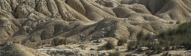
The impact of climate change on natural groundwater recharge in a semiarid area has been assessed for southeast Spain. This was done for a high- and low-end scenario of climate change (A2-high and B2-low), three future time series (2011–2040, 2041–2070 and 2071–2099), and one global climate model (selected after comparison with two other models) (48). A decrease in annual precipitation of up to 1.1% per decade and an increase in the mean air temperature of up to 0.4°C per decade is projected for this part of Spain. The number of days without precipitation is projected to increase, from 325 days per year during the period 1961–1990 to 344 days per year during 2071–2099. Dry summer periods will last longer. During 1961–1990, 53% of the years showed annual precipitation to be 200–350 mm, classified as a semiarid climate. At the end of the 21st century, the years with precipitation below 200 mm per year will predominate, which corresponds to an arid climate. These results, along with the expected increase in air temperature, are indicators of climate aridification. As a result, for both scenarios, the average groundwater recharge will decrease by 3% during (2011–2040), 8% during (2041–2070) and 17% during the last period (2071–2099) compared with the recharge during 1961–1990. The water table has already dropped more than 70 m over the last three decades. These reductions in recharge could affect dependent groundwater supplies. In this part of Spain, many small towns only use groundwater resources (48). These results agree with those of previous studies for Majorca (49), southwest Spain (50) and southeast Spain (51). Lower reduction of groundwater recharge was projected for the north of Spain (52), due to the wetter climatic conditions.
Vulnerabilities - Reservoirs
2003 was the driest year in Spain in at least 60 years. Fresh water supply of Barcelona depends largely on the Sau reservoir. In the summer of 2003 this reservoir was filled only up to 18% of its capacity. The church of a drowned village that is normally at the bottom of the reservoir, was high above the water level, as a symbol of the severity of the water crisis. Water supply in this area has become more critical over the years, not only due to a reduction of rainfall, but also due to an increase of the demand as a result of the population growth of Barcelona (up to 5 million) and an increase of agriculture (more irrigation). In the summer of 2003 water was shipped from Marseille to Barcelona (1).
By 2030 a 5-14% reduction of fresh water resources is projected. By 2060 this may be 17% and at the end of the century 20-22% (8). In the worst case by the period 2081–2100, even a decrease of river discharge in a small catchment in central Spain up to 48.7% was projected, thus threatening the functioning of reservoirs (27). The interannual variability may also increase. Severe impacts are expected in arid and semi-arid areas (approximately 30% of the national territory), where water yields may decrease by 50% (8, 27). The impact will be most severe in the catchments of Guadiana, Canarias, Segura, Júcar, Guadalquivir, Sur and Baleares (6).
Vulnerabilities - Glacier-fed and snowmelt rivers
The Pyrenees have lost almost 90% of their glacier ice in the previous century and the rest may disappear within a few decades. The melting rate of the ice that is still there keeps increasing: between 2002 and 2008 the Spanish Pyrenees lost about a quarter of their volume (7). The loss of these glaciers will have a severe impact on summer water supplies in the foothills and southern plains south of the Pyrenees. There may be dramatic effects to agriculture as glaciers that feed rivers disappear, taking away a major source of summer water. The glaciers under threat in Spain feed rivers such as the Gállego, the Cinca and the Garona which water the foothills and plains south of the Pyrenees.
The major river basins (the largest of which are the Ebro, the Garonne and the Adour), situated downstream of the region, are supplied from the Pyrenees water resources. Reductions of up to 40 % of the flow of the Garonne river (55), 0–35 % of the flows of the Catalan rivers (56) and 20 % of the flow of the Ebro river in the summer season are projected for 2060 (57).
The headwaters of the main Spanish rivers are located in mountainous territories where late-autumn and winter precipitation falls in the form of snow leading to the formation of a sustained snowpack. Hydrology of 27 mountain rivers was studied that were not disrupted by major human interference (e.g., dams or reservoirs) (35). This was done for the period 1976–2008. These rivers are considered representative of the wide variety of mountainous rivers in continental Spain, as at least one river in every high-elevation mountain chain was studied. It was shown that the spring peak derived from snow-melting is either losing relevance with respect to winter flows, or is shifting earlier in time. In the majority of cases the observed shift accounts for more than 8 days/decade, i.e. 4 weeks during the studied period, although not for all rivers the observed trends are statistically significant (at the 95% confidence level). The decrease in the snowfall/rainfall ratio in winter and the earlier snowmelt in spring are thought to be the main causes for the observed changes in streamflow timing. Hydrological simulations for two of these studied rivers for the period 2035-2065 with respect to 1970-2000 (A1B emissions scenario) indicate further shifting of spring peak flows along with a more pronounced low water level period in the summer (35).
Vulnerabilities - Rivers and streams
Climate change and climate variability affect the discharge of river basins. One would expect river discharge in, for instance, southern Europe to decrease in direct response to less precipitation, more evaporation from soils, streams, reservoirs, and lakes, and more transpiration by plants. The relationship between changes in climate and changes in river discharge is not so straightforward, however. Several other developments in a river’s catchment, including human water use, irrigated agriculture, and land use change can obscure or even reverse the impact of climate change on river discharge. Human factors are sometimes more important than climate in understanding changes in river discharge over time. For the Atlantic part of Europe, from the south of Spain to the north of the UK, a study was carried out to disentangle the contributions of climate change versus human impacts on river discharge. Long‐term trends in annual river discharge from a very dense network of 1874 gauging stations spanning the period 1961-2012 were analysed for this (58).
Discharge has increased in the North, and decreased in the South
Across much of the British and Irish Isles, trends of increasing river discharge dominate. In contrast, most stations across the Iberian Peninsula and southern France show decreasing trends. Both the increasing trends in the North and the decreasing trends in the South are statistically significant. Northern France and central and southern Great Britain are transitional, with few significant trends. These trends agree with trends in annual precipitation totals that also show a north‐south gradient, characterized by significant increasing trends in the north of the British and Irish Isles, and predominantly significant decreasing trends in northern parts of the Iberian Peninsula and southern France. The spatial coherence between changes in river discharge and evaporation is much less (58).
Link with climate change in the North, mismatch in the South
For the British and Irish Isles most observed trends in annual river discharge are associated with climate change. In Spain, however, there is a clear mismatch between observed trends in river discharge and climate. Especially for the river basins in the south of Spain, river discharge has decreased more than expected, given annual precipitation and evaporation. This may be due to a large surface cover of irrigated crops: irrigation may have declined groundwater resources, producing feedbacks that finally contribute to the strong observed decline of river discharge (58). Also, depopulation has led to the abandonment of agriculture and grazing lands in these regions (59), with a subsequent and rapid natural afforestation (60) that increased water consumption by vegetation and reduced runoff to the river (61).
In southern France, trends in river discharge seem to be mostly driven by climate. Compared with the Iberian Peninsula, vegetation cover has not increased much here since land abandonment and natural afforestation have been modest (62). Also, crop irrigated areas represent a small and stationary percentage of basin land cover in southern France (63).
Effect wildfires: increase river discharge
In the north and west of Spain and Portugal the pattern is opposite to the one in the south: river discharge has increased more than expected from climate alone. This region has been frequently impacted by wildfires in past decades. River discharge can increase after fire events when a substantial part of the river basin is burned (64).
Vulnerabilities - Case studies
Ebro Delta
The Ebro catchment is the largest basin in Spain. It drains an area of about 85,000 km2 in north-eastern Spain. The water system is concentrated around the Ebro, a 910 km long river flowing from the Cantabrian Mountains to the Mediterranean Sea. In 2007, agricultural water demands represented 92% of total demand, followed by domestic water demands (3.8%), the industrial sector (2.7%) and water transfers (1.5%) (21). With its 940,000 irrigated hectares, the Ebro basin is host to one fifth of the country’s irrigated area (22). It is a key element in the Spanish agricultural production with, respectively, 30% and 60% of the meat and fruit production of the country (21). The Ebro catchment also represents 8.8% of the national Spanish industrial production and produces 25% of the hydro-electrical energy in Spain (23).
Current situation
Over the 1957–2002 period, mean annual discharge of the Ebro River decreased due to climatic variability (a rise of 0.7°C in mean annual temperature and a 12% decrease in mean annual precipitation (24), reforestation processes (25) the building of 230 storage-dams along the Ebro River for hydropower production and irrigation water supply purposes, and the increase in water demands (26).
The observed increase in the number of melt events in the winter (December to March) at altitudes >2000m a.s.l. in the Pyrenees during recent decades (28) explains the change in snow accumulation (29) and in the river regimes of mountain headwaters in the Ebro basin, where winter runoff has increased in importance relative to spring flows (30). Currently, winter snow accumulation controls more than 40% of the spring runoff, and determines the capability to fill the Pyrenean reservoirs which supply water for large irrigation areas in the dry Ebro valley (31).
Future projection
Monthly freshwater supply in the Ebro basin was estimated for each year of the reference climate period 1971–1990 and the future climate period 2041–2060 (26). Projections of climatic changes were based on outputs from four Global Climate models (GCMs) and the A2 greenhouse gas emission scenario which corresponds to a major increase in greenhouse gas emissions, and thus to very substantial changes in climate. Currently, water resources and current dam management fully satisfy environmental, domestic and agricultural water demands all year round. At the 2050 horizon, on average, temperatures are expected to rise by 3°C and precipitation to decrease by 10–25% during spring and summer. As a result, water resources could drop by 15–20% in Pyrenean sub-catchments and by 25–35% in the Ebro valley. In addition, population is projected to increase (+0.5 millions), especially in the Ebro valley, and irrigated areas are expected to expand by 30% mostly in already highly productive areas. The combined effect of decreasing water resources and increasing water demands could lead to water shortages in the Pyrenean sub-catchments in summer (26).
The combined effect of changes in recharge, crop water demand and sea level rise on groundwater levels and flow into coastal wetlands was studied for three Mediterranean areas: the Central Algarve (Portugal), the Ebro Delta (Spain), and the Atlantic Sahel (Morocco) (19). This was done for combinations of a Regional Climate Model (RCM) and a driving Global Circulation Model (GCM) under the IPCC A1b climate scenario, for the periods 2020–2050 and 2069–2099, and compared with 1980–2010 (for the Portuguese and Moroccan sites) and 1960–1990 (for the Spanish site). According to the results:
- Crop water demand will increase steadily, causing 15–20 % additional evapotranspiration until 2100.
- Groundwater recharge will decrease toward the end of the century (mean >25 %) in all three areas.
- The response of groundwater flow to the projected decreases in recharge and increases in pumping rates will be a strongly reduced outflow into the coastal wetlands. Near the Ebro delta, a reduction of 20 % in spring discharge into the wetlands is expected at the end of the century.
- The impact of sea level rise is insignificant when compared to the decrease in recharge and increase in crop water demand: under many circumstances, intensive pumping near the coast is a more important trigger of seawater intrusion than sea level rise itself.
- In the long term, water availability in the three regions is projected to decrease substantially and, together with increasing water demands, may seriously affect the wellbeing of humans and ecosystems that depend on groundwater for their subsistence.
The impacts of future climate change on water resources for the Gállego river basin, a tributary of the larger Ebro River, has been examined from an ensemble of 6 Regional Climate Models (RCMs) run for the period 2071–2100 under the SRES A2 emissions scenario. Projected water availability for the Gállego is lower for 2071–2100 than for 1961–1990, with an increasing number of dry years (20).
According to climate change projections for the periods 2021–2050 and 2051–2080, compared with 1961-1990, based on 12 regional climate models and the A1B emissions scenario, the number of warm winter nights (December to March) will continue to increase, especially in the mountain areas (28). In this study, warm nights were defined as nights with minimum temperature higher than the 90th percentile of all minimum temperatures calculated for the reference period 1961-1990. These projected changes will significantly impact on snowpack as a consequence of changes in snowfall/precipitation ratio and an earlier snowmelt, and threat the water supply for agriculture and domestic use (32). An increase of winter runoff and a decrease of spring runoff could force to change the reservoirs’ management strategies (30), with an earlier filling that reduces the possibility to control floods (33). Such reduction is problematic because temperature increases may result in more frequent winter floods in rivers of the snow dominated headwaters (34).
Bay of BIscay
In Europe there is a clear contrast between the North and the South of the continent: an increase in precipitation and water discharge has been pointed out in the North, and a decrease of precipitation and discharge in the South. The Bay of Biscay seems to be located in a transition zone between these two areas: the arid climatological conditions projected for southern Europe do not seem to be representative for this region. From an assessment based on 5 climate models (GCMs) and an intermediate and high-end scenario of climate change (the so-called RCP 4.5 and RCP 8.5 scenarios) it was concluded that seasonal discharge at the end of this century may decrease by around 17% in autumn, 16% in spring, 11% in winter and 7% in summer, when compared with the reference period of 1961-2000. These results are in line with those predicted for the Atlantic region (France and the Iberian Peninsula) (54).
Europe: five lake categories
There are almost one and a half million lakes in Europe, if small water bodies with an area down to 0.001 km2 are included. The total area of lakes is over 200,000 km2; in addition the manmade reservoirs cover almost 100,000 km2. The response of European lakes to climate change can be discussed by dividing the lakes into five categories (9):
Deep, temperate lakes
Typical representatives of this class are e.g. Lakes Maggiore, Ohrid, Geneva and Constance with mean depths of 177, 164, 153 and 90 meters, respectively. Due to the great depth and relatively mild winters, there is usually no ice cover. The future climate change in Europe may suppress the turnover in deep lakes. This implies the enhancement of anoxic bottom conditions and an increased risk of eutrophication. The oxygen conditions can also be anticipated to deteriorate due to increased bacterial activity in deep waters and surficial bottom sediment.
Shallow, temperate lakes
Balaton (600 km2, 3 m) in Hungary and Müritz (114 km2, 8 m) in Germany belong to this class. Increasing water temperatures may result in intensified primary production and bacterial composition. The probability of harmful extreme events, e.g. mass production of blue-green algae, will increase. The impacts may extend to fish life; changes in species composition and reduced fish catches will be anticipated. The use of the expression 'thermal pollution' is well justified for these lakes.
Boreal lakes
Ladoga (17 670 km2, 51 m), Onega (9670 km2, 30 m) and Vänern (5670 km2, 27 m) are the largest in this class, being also the three largest lakes in Europe. This group includes about 120 lakes with an area exceeding 100 km2. Most lakes of the boreal zone mix from top to bottom during two mixing periods each year. Shortening of the ice cover period will be the most obvious consequence of climate change in these lakes. This could improve the oxygen conditions in winter and spring.
Arctic lakes
These are mainly small water bodies in northern Scandinavian mountains and in the tundra region. Arctic lakes are generally considered to be particularly sensitive to environmental changes. Melting permafrost may seriously threaten the ecosystems of arctic lakes. In some cases the whole lake may disappear as a consequence of ground thaw and enhanced evaporation.
Mountain lakes
To this class belong all high altitude lakes in central Europe and also those located in southern Scandinavia. Even if mountain lakes were connected by channels, physical and ecological constraints limit species migration between them. In a warming climate, there is no escape route; the only possibility for survival is adaptation.
Fresh water resources in numbers - Europe
The total renewable freshwater resource of a country is the total volume of river run-off and groundwater recharge generated annually by precipitation within the country, plus the total volume of actual flow of rivers coming from neighbouring countries. This resource is supplemented by water stored in lakes, reservoirs, icecaps and fossil groundwater. Dividing the total renewable freshwater resource by the number of inhabitants leads to water availability per capita. Thirteen countries have less than 5,000 m3/capita/year while Nordic countries generally have the highest water resources per capita. The Mediterranean islands of Malta and Cyprus and the densely populated European countries (Germany, Poland, Spain and England and Wales) have the lowest water availability per capita. The water availability is an annual data which therefore does not reflect at all seasonal variations (10).
Abstraction non-renewable groundwater reserves
‘‘Non-renewable groundwater’’ denotes groundwater gained by abstraction in excess of recharge. The amount of non-renewable groundwater abstraction that contributes to gross irrigation water demand has been calculated for a large number of countries, allowing for a global overview. The results of this study show that non-renewable groundwater abstraction globally contributes nearly 20%, or 234 km3 annually, to the gross irrigation water demand (for the reference year 2000) and has more than tripled in size since the year 1960. From 1960 to 2000 an increased dependency was shown of irrigation on non-sustainable groundwater with time. Thus, irrigation is more and more sustained by an unsustainable water source (12).
Country assessments reveal that non-renewable or non-sustainable groundwater supplies large shares of current irrigation water, particularly for semi-arid regions where surface freshwater and rainfall are very scarce: Pakistan, Iran, Saudi Arabia, Libya, UAE and Qatar. Much of current irrigation in these regions is sustained by non-sustainable groundwater (12).
For Europe, the contribution (%) of non-renewable groundwater abstraction to gross irrigation water demand was calculated for Italy (15%), Spain (7%), Turkey (7%) and Greece (2%) (12). Projected increases in irrigation demand in southern Europe will serve to stress limited groundwater resources further (15).
Substantial reductions in potential groundwater recharge are projected for the 21st century in southern Europe (Spain and northern Italy) whereas increases are consistently projected in northern Europe (Denmark, southern England, northern France) (13). Along the southern rim of the Mediterranean Sea decreases in potential groundwater recharge of more than 70% by the 2050s have been simulated using output from two climate models (ECHAM4, HadCM3) under two emissions scenarios (A2, B2) (14).
Adaptation strategies
EU policy orientations for future action
According to the EU, policy orientations for the way forward are (11):
- Putting the right price tag on water;
- Allocating water and water-related funding more efficiently: Improving land-use planning, and Financing water efficiency;
- Improving drought risk management: Developing drought risk management plans, Developing an observatory and an early warning system on droughts, and Further optimising the use of the EU Solidarity Fund and European Mechanism for Civil Protection;
- Considering additional water supply infrastructures;
- Fostering water efficient technologies and practices;
- Fostering the emergence of a water-saving culture in Europe;
- Improve knowledge and data collection: A water scarcity and drought information system throughout Europe, and Research and technological development opportunities.
Managed aquifer recharge
Comprehensive management approaches to water resources that integrate ground water and surface water may greatly reduce human vulnerability to climate extremes and change, and promote global water and food security. Conjunctive uses of ground water and surface water that use surface water for irrigation and water supply during wet periods, and ground water during drought (16), are likely to prove essential. Managed aquifer recharge wherein excess surface water, desalinated water and treated waste water are stored in depleted aquifers could also supplement groundwater storage for use during droughts (17,18). Indeed, the use of aquifers as natural storage reservoirs avoids many of the problems of evaporative losses and ecosystem impacts associated with large, constructed surface-water reservoirs.
Measures - Spain
The plans to send water from the northwest (Ebro) to the arid zones of the southeast have been cancelled. Instead, the government is building more desalination plants, adding to the more than 900 already in Spain - the largest number in any one country outside the Middle East. A giant desalination plant on the edge of Barcelona should provide 180,000 cubic metres of water a day (1). Spain is the largest user of desalination technologies in the western world. Globally, it ranks fourth behind Saudi Arabia, the United Arab Emirates and Kuwait, and first in the use of desalinated water for agriculture (2).
The government of Catalonia has instructed all schools to add water conservation to the school curriculum (1).
Examples of successful use of wastewater in agriculture exist in Gran Canaria, where 20 % of water used across all sectors is supplied from treated wastewater, including the irrigation of 5,000 hectares of tomatoes and 2,500 hectares of banana plantations (4). Similarly, tertiary treatment of wastewater in the city of Vitoria, the administrative capital of the Basque Country, has provided 3 Hm3/ year of irrigation water for nearby agricultural land, with a plan to increase the volume irrigated in the future to 8 Hm3/year (4). Increased irrigation efficiency can, however, result in either no change or even an increase in water used, when the gains in efficiency simply drive an expansion of the irrigated area (2).
Water pricing policy
Little information is available to assess the success and limitations of water pricing in agriculture and to identify optimal implementation practices. A new approach is introduced for the Guadalquivir river basin, where the water price includes both a fixed and variable charge linked to water use, with farmers paying, on average, significantly more than under the original area-based approach. This has resulted in a 30 % reduction in water consumption (for the same crop types) equating to approximately 2,000 m3/ha of water saved per year (5).
Water pricing system includes charges for services provided by river basin authorities to irrigation associations, municipal services and industrial users. Urban tariffs to domestic and industrial users include three block
tariffs to penalise excessive usages. Industrial tariffs discriminate for bigger users in the fixed and variable
charges. An increasing number of irrigation associations are establishing charges by volume and penalisation for excessive use when scarcity occurs (10).
Desalination
Water supply in Spain throughout the 20th century has been based on building and enlarging water infrastructure rather than focusing on demand management. After dams and inter-basin water transfers, desalination has become the new alternative (36) for solving the differences in supply between the ‘‘dry’’ and ‘‘wet’’ parts of the Iberian Peninsula.
In 1965, the first desalination plant in Spain was built in Lanzarote (Canary Islands). Desalination is also important on the other Balearic and Canary islands, and along the Mediterranean coast (37), especially near Málaga (where according to some estimates, desalted water may cover up to 40% of the water needs of the Costa del Sol) and in the provinces of Murcia and Alicante.
Desalination is being presented increasingly as a techno-social fix, against the pressures of urbanization, climate change and population on freshwater resources (38). There is also a downside, however: negative effects on marine ecosystems (39), high-energy consumption and high CO2 emissions (40). Furthermore desalination may increase water prices, induce uncontained urban growth, shift geopolitical relations of water security and increase dependence on technical expertise as well (41). Desalination, finally, and as happens with other large-scale water projects, such as water transfers, may fall prey to misleading projections of water demand based on scenarios of intense agricultural, urban and tourist growth (42).
Over the last years, 95% of desalted water in Spain served urban and tourist purposes and only 5% went to irrigation (43). Desalted water is too expensive for farmers (44): given current energy costs, the cost of producing desalted water would be situated between 0.9 and 1 €/m3 (including all ancillary charges). The evolution of urban and tourist water consumption in the 1990s and early 2000s, on the other hand, appeared to justify the recourse to desalination. After the burst in the real estate market in 2008, however, thousands of projected new homes were cancelled making redundant the need of water and leaving some municipalities unable to comply with the agreements signed to use desalted water. The decrease in water consumption is also due to water conservation and awareness campaigns (45), socio-demographic changes (46), technical improvements in water delivery systems reducing leaks and other losses, and abundant precipitation in the last 4–5 years (42).
All in all, according to the Spanish Minister of Agriculture, Food and the Environment, in 2012 only 16% of the total capacity of desalination plants in Spain was actually used (47). Water scarcity for the urban and tourist sectors of the Spanish Mediterranean coast could be overcome with desalination. The extra capacity will not be used by farmers to offset scarcities caused by future droughts, however, because of the high price (44). Farmers turn to other options such as treated wastewater, water purchased from other irrigation communities, grey water reuse, rainwater harvesting, or even desalted water mixed with other water sources to decrease costs (42).
References
The references below are cited in full in a separate map 'References'. Please click here if you are looking for the full references for Spain.
- news.bbc.co.uk
- European Environment Agency (EEA) (2009)
- Custodio (2002), in: European Environment Agency (EEA) (2009)
- Mediterranean EUWI Wastewater Reuse Working Group (2007), in: European Environment Agency (EEA) (2009)
- Maestu (1999), in: European Environment Agency (EEA) (2009)
- Government of Spain. Quinta Comunicación Nacional de España
- Ministerio de Medio Ambiente, y Medio Rural y Marino (2008)
- Oficina Española de Cambio Climático (2008)
- Kuusisto (2004)
- European Commission (DG Environment) (2007)
- Commission of the European Communities (2007)
- Wada et al. (2012)
- Hiscock et al. (2011), in: Taylor et al. (2012)
- Döll (2009), in: Taylor et al. (2012)
- Falloon and Betts (2010), in: Taylor et al. (2012)
- Faunt (2009), in: Taylor et al. (2012)
- Scanlon et al. (2012), in: Taylor et al. (2012)
- Sukhija (2008), in: Taylor et al. (2012)
- Stigter et al. (2014)
- Majone et al. (2012)
- CHE (2011), in: Milano et al. (2013)
- Pinilla (2006), in: Milano et al. (2013)
- MMA (2000), in: Milano et al. (2013)
- Milano (2012), in: Milano et al. (2013)
- Gallart and Llorens (2004); López-Moreno et al. (2010), both in: Milano et al. (2013)
- Milano et al. (2013)
- Molina-Navarro et al. (2014)
- López-Moreno et al. (2014)
- López-Moreno (2005), in: López-Moreno et al. (2014)
- López-Moreno and García-Ruiz (2004), in: López-Moreno et al. (2014)
- López-Moreno and García-Ruiz (2004); García-Ruiz et al. (2011), both in: López-Moreno et al. (2014)
- López-Moreno et al. (2008a), in: López-Moreno et al. (2014)
- López-Moreno et al. (2002), in: López-Moreno et al. (2014)
- Beniston (2005), in: López-Moreno et al. (2014)
- Morán-Tejeda et al. (2014)
- Jefatura del Estado (2004, 2005), in: March et al. (2014)
- Masjuan et al. (2008), in: March et al. (2014)
- Swyngedouw (2013), in: March et al. (2014)
- Sadhwani et al. (2005); Bernat et al. (2010), both in: March et al. (2014)
- Meerganz von Medeazza (2004); Sadhwani et al. (2005); Bates et al. (2008); Bernat et al. (2010), all in: March et al. (2014)
- McEvoy and Wilder (2012), in: March et al. (2014)
- March et al. (2014), in: March et al. (2014)
- Olcina Cantos and Moltó Mantero (2010), in: March et al. (2014)
- Rico-Amorós (2010), in: March et al. (2014)
- March et al. (2013), in: March et al. (2014)
- March et al. (2012), in: March et al. (2014)
- Cortes Generales (2012), in: March et al. (2014)
- Touhami et al. (2015)
- Younger et al. (2002), in: Touhami et al. (2015)
- Guardiola-Albert and Jackson (2011), in: Touhami et al. (2015)
- Pulido-Velazquez et al. (2014), in: Touhami et al. (2015)
- Raposo et al. (2013), in: Touhami et al. (2015)
- Sapriza-Azuri et al. (2015)
- Meaurio et al. (2017)
- MEDDE (2013), in: European Environment Agency (2017)
- ACA (2009), in: European Environment Agency (2017)
- Confederación Hidrográfica del Ebro (2005), in: European Environment Agency (2017)
- Vicente‐Serrano et al. (2019)
- Lasanta‐Martínez et al. (2005), in: Vicente‐Serrano et al. (2019)
- Lasanta and Vicente‐Serrano (2007), in: Vicente‐Serrano et al. (2019)
- Robinson et al. (2003), in: Vicente‐Serrano et al. (2019)
- Mottet et al. (2006), in: Vicente‐Serrano et al. (2019)
- Campardon et al. (2012), in: Vicente‐Serrano et al. (2019)
- Hallema et al. (2018), in: Vicente‐Serrano et al. (2019)


